I’ve been in Phoenix for about 90 minutes; here to attend a conference put on by my employer. While I can now say I’ve see this Southwestern city, it’s not a city that will rank high on my list of vacation spots to which I might return. I was booked at the Wyndham Phoenix, a nice enough hotel in the city “center” and surrounded by downtown and civic buildings. My arrival was heralded by a blast of hot air that snuck between the 737’s fuselage and the jet way…still hot at about 7:00 p.m. Settled into the hotel to find that something had leaked on one of my dress shirts and, after procuring some Woolite from the concierge, took off for a walk. I set out a few blocks east, then south, on a route that ended up being approximately 2 miles. The atmosphere of the city was strange. At 8:00 p.m. the streets were what one might call “sterile.” There was no one else out for a walk, and the only people I saw along the way were numerous police officers and parking lot security guards. Even the homeless were conspicuous in their absence. (Only saw two street people and one was snoring away.)
Category Archives: Vacation & Travel
our first opening day
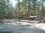
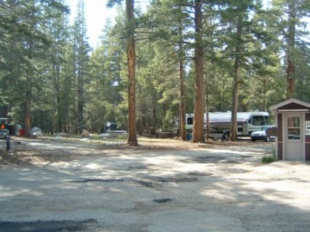
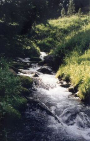
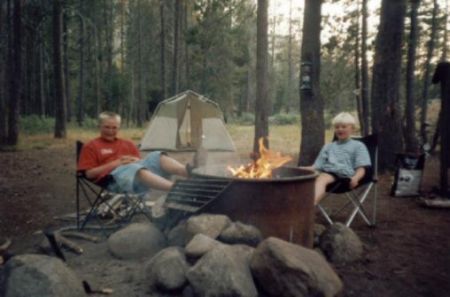
What a learning experience! Chris and I approached this as more of a learning experience, and it was a good thing we did so. After getting up at oh-dark-thirty, we headed up the Lyons Canal in Twain Harte (Nick and Nathan, that’s were we have taken you fishing.) and found nothing going on, so we departed for Moccasin Creek. It’s about thirty minutes away, and because we though the only access was through a gate, we delayed our arrival until about 7:00 a.m.
We found out upon arrival that there was a trail that allowed access around the gate, and from all appearances, some folks set up prior to the 6:00 a.m. opening. Most were bait fishing right around the dam, so we headed downstream a bit. Targeting pools, Chris and I had some good strikes on spinners. A gold/red Panther Martin for me, a gold Mepps for Chris. Devin, Chris’ friend who had come with us, also had a few. Devin hooked one fish but lost it; Chris hooked quite a few and landed five. I hooked three solid fish.
Though I didn’t land any (using barbless lures for the first time), I did hook one that was probably the biggest trout I’ve ever had the opportunity to play. Using 4 lb. line, I didn’t want to be too aggressive, so had my drag set low. Then, zzzzzzzzzzzzzzz. The line peels off the reel as this fish takes off for one side of the stream (about 15-feet across), then back again. It did this six or seven times, then took off downstream, again taking line. Then it was upstream. I figure this went on for about four, maybe five minutes. I finally gained some ground, edge him in…four feet…three feet…and he raises his head and throws the hook. What a fight! Know I understand these folks who year after year chase after that one big fish they hooked by never landed.
Mid-morning we headed out to check a few other places, again don’t some reconnaissance for future trips. One stream had terribly limited access. We drove up to Lyons Reservoir, and while a beautiful place, the action was limited to bait. Devin hooked another fish here. We made one last visit to Lyons Canal, figuring the crowds had died down. We saw a few fish, but they were a bit cagey and the neighborhood dog wasn’t helping by jumping into the water. (Ask Chris about that.)
All in all, it was a good experience, and we gained some good knowledge that will help us in the future. And I’ll be back to Moccasin Creek looking for that bruiser…
A Great Side Trip to Tuolume Meadows
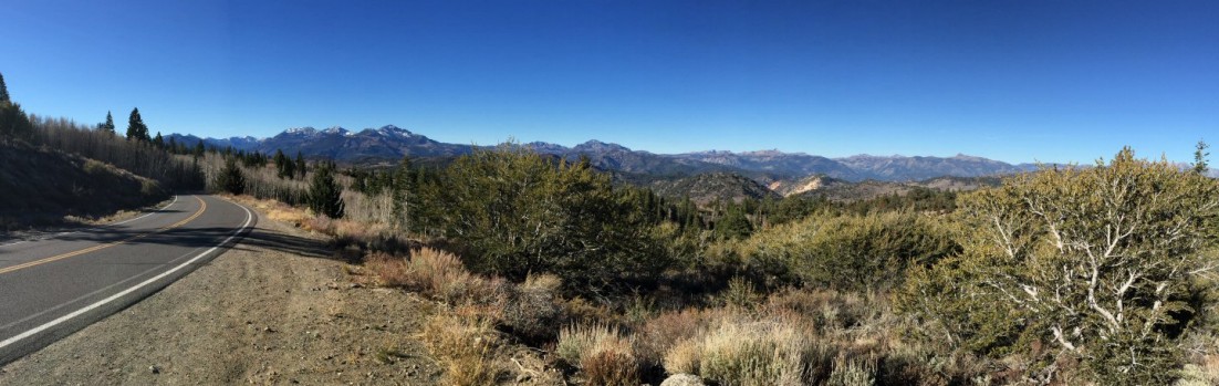
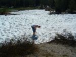
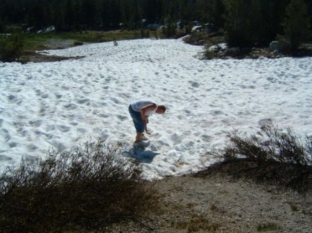
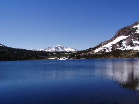
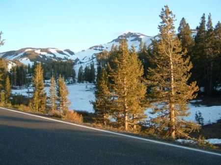
During a visit to the cabin during July 2005, we – Pat, Sean and Chris – decided to take a long day trip over the Sonora Pass and to Tuolumne Meadows. If you browse through the photos below, you can see there was quite a bit of snow covering the mountains around the pass and up to the roadway. We made good time and soon were climbing up Tioga Road (Hwy 120) in Lee Vining Canyon. By the way, at the base of the road there is new Mobil station with a restaurant – pretty convenient though it is quite expensive. It was a nice drive, though, as very few people seemed to be in this neck of the woods. For those who are observant, you’ll see a one or two pictures the gathering clouds of an afternoon thunderstorm.
The water was high everywhere through the canyon and Tuolumne Meadows. It was quite amazing. Even the various agencies (National Forest, National Park Service and state park system) had posted temporary signs warning of high water and the possibility of hikers having to cross swollen streams.
Exactly three hours later, we arrived at the Tioga Pass Entrance Station. The sky was clear, snow was all around and the water was high. I had forgotten how beautiful it was. The pass only opened on June 24, a tad bit more than two weeks prior to our visit and the campground would not open for another two days.
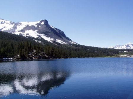
One of our first stops was Tioga Lake. While we were there, two fly fisherman were floating on tubes, with their legs in the very cold water. During our stop, Sean just had to assemble a snowball – a bit of a novelty in July. The snow was different from what one might be accustomed to seeing as there was no human activity interfering with its melting…at least until we arrived!
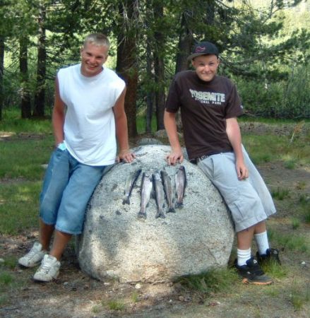
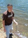
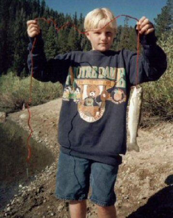
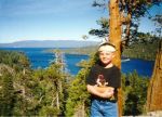
Striking a pose similar to one in a photo of my sister and brother and I with a stringer, probably in the mid 1970s.
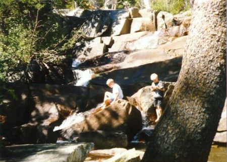
I think the whole day was made worthwhile for Sean (and me) at Lee Vining Creek. During all of our visits to the streams of the Sierra, the trout seemed to know Sean was coming. But Chris, during a previous visit to the Lee Vining Canyon with Boy Scouts, directed us to this little bend in the Lee Vining Creek – which is more of a small river. Sure, they were prob’ly hatchery trout, but they sure were fun to catch. Near as we can recall, without “fisherman’s exaggeration” creeping in, Sean pulled in about six fish, Pat about ten and Chris maybe a dozen or so. Five are in the freezer awaiting their fate.
The nice thing about this jaunt is that we weren’t in a hurry. We took our time on the return leg, driving through June Lake Loop about five-ish and finally reaching Bridgeport close to six. After gobbling down some grub at the ‘Jolly Cone’ we then headed up the road, passing the Marine Corps’ Mountain Warfare Training Center. Along the way we stopped to take in a few vistas – the slowness forced by the twists and turns of the road force one to take in the beauty along the way.
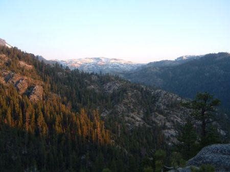
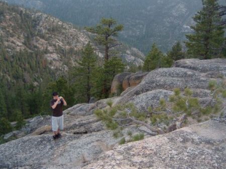
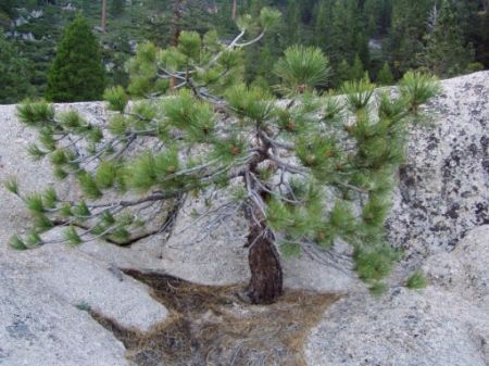
After cresting Sonora Pass, Chris wanted to use his new camera, so we stopped at the East Flange Pass overlook. (Apparently, this pass used as a landmark by the pioneers and Forty-Niners as they descended from Sonora Pass.) Chris jumped out, scrambled around the granite formation and found a small tree for his subject. The photo in the album is looking towards the southern Sierra Nevadas and Yosemite.
Our last stop was at the Dardanelles Reservoir, about thirty miles from Twain Harte and viewed from a fantastic overlook. We arrived about 8:30 p.m., just as the sun was setting. From the overlook one peers down into a deep canyon at the reservoir, which I have read has little accessibility because of the steep canyon walls, but does harbor some trout. I hope to return during daylight hours as one is offered a tremendous view up and down the canyon and to the mountains north. About forty minutes later we were ‘home’ at the cabin, just in time to wash the smell of fish from our bodies (I even had fish stuff on my shirt). Yeah, it was a long trip but a great trip that I would gladly undertake again.
-
- The Tioga Pass Entrance station.
-
- There will always be much debate, but I believe this is the campsite we (Luci, Mark and I) visited as kids.
-
- We were a bit surprised at the amount of snow, even at the higher elevations.
-

- Tioga Lake, looking north.
-
- Tioga Lake, looking east.
-
- We found some trout in Lower Lee Vining Creek, near the powerhouse.

-
- Chris with a fish out of Ellery Lake. He was the only one lucky enough to catch fish there.

-

- Striking a pose similar to one in a photo of my sister and brother and I with a stringer, probably in the mid 1970s.
-
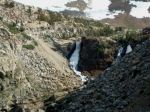
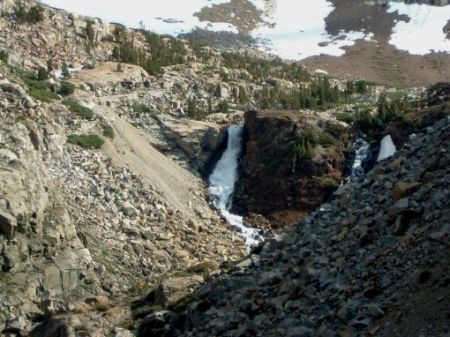
- A waterfall near the top of Sonora Pass.
-

- Snow on Sonora Pass.
-

- Sunset from the East Flange Pass Overlook.
-

- Chris working his photography skills.
-

- The photo Chris took.
My First Visit to New Orleans (Pre-Katrina)
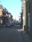
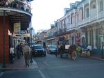
When I shifted to a new position at work, it was decided that I might get a quick education by attended on of our conferences, so it was off to New Orleans. (The fact that it was in New Orleans and that I had never been there convinced me that it might be a good thing.) I was put up at the Alexa Hotel, which has (had?) and entrance on Bourbon Street. At this end, it sure did not seem like much, but that may have been because my visit was in the early afernoon, apparently before many folks had awakened.
Further down Bourbon, things got a bit more lively. At a bare minimum, every block inlcudes some kind of bar, restaurant, t-shirt shop, smoke/cigar shop, gift shop and strip club. Even if there is just a hole in the wall just big enough for a cooler, someome will be selling beer or cocktails out of it. And every bar has cocktails to go!
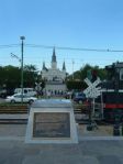
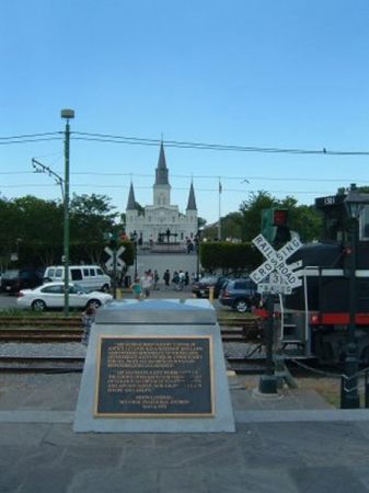
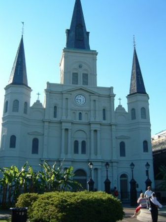
I had decided that during my first evening in New Orleans that I would chase down a highly recommended restaurant for some old-school New Orleans food. On the way there, I passed the St. Louis Cathedral, as I left Bourbon Street and headed towards the Mississippi River. During his second visit to the United States, Pope John Paul II celebrated there. The St. Louis Cathedral, completed in 1794 and the oldest church in New Orleans, can be seen from Jackson Square, which has always been an open area in the heart of the French Quarter. Originally known as the Plaza d’Armas, this common area was used at times as military parade grounds, and later as a market place for fish, fowl, and produce. It faces the Mississippi River and contains a statue of its namesake, Andrew Jackson, the hero of the Battle of New Orleans. In the square is a memorial to the Louisiana Battalion Washington Artillery, which has fought in every major war since the Civil War.
St. Louis Cathedral also can be seen from the banks of the Mississippi River. Crossing through Jackson Sqaure puts one on Decatur Street, which I found more to my liking than Bourbon Street. Decatur Street is where one can find Sbisa’s Café, Central Grocery Co. and the Café du Monde (of beignet fame). I had my first New Orleans meal at Sbisa’s and highly recommend it for its great seafood. I thoroughly enjoyed my dinner, which started with Bayou Crab Cakes with spring onion salad and a mustard-based Creole sauce, and Seafood Gumbo, followed by an entrée of Blackened Redfish topped with fried, jumbo Gulf shrimp and Creole sauce. (The view over Decatur is nice and the staff was great.) It was nice for me – though not so nice for the restaurant – that all was eerily quiet when I made it Sbisa’s Café. As I mentioned, the cafe offers a nice view from the balcony, with music from a jazz piano floating up from the ground floor. Dinner was followed by a serving of beignet, after which I rolled back to my hotel.
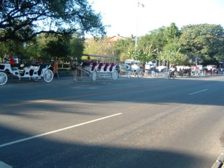
Along Decatur Street, just in front of Jackson Square, is where the various tour carriages line up. Though people hold the reins, it was funny to watch the mules automatically organize themselves as they lined up behind each others’ carriages. So habitual is this behavior, one attendant, who was not paying attention, had to run after his carriage.
I passed by the statue of Andrew Jackson again Thursday night…but not because I had meant to. I was in search of The Praline Connection, a down-home-style restaurant recommended by my sister and her husband, but was misdirected and ended up walking through the Warehouse District before I found that The Praline Connection I was sent to was the second Praline Connection, leaving me to walk back across the Warehouse District and all the way across the French Quarter. I was just about to give up when I turned a corner and there it was. I do not know if it was my hunger, but the food was good (alligator sausage followed by fried chicken with cornbread, red beans and rice, and potato salad). Dessert was a praline to go. Based on mapping my route on the computer, I walked about six miles in search of this dinner!
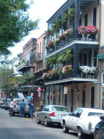
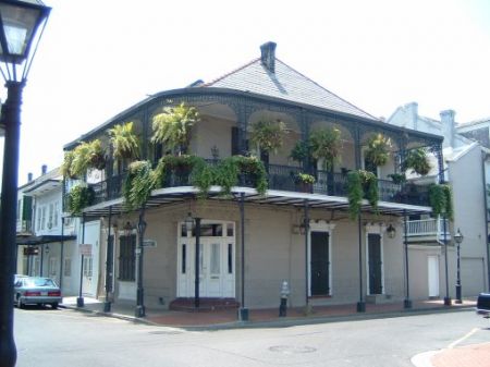
Look at the album and you’ll see some of the amazing vegetation in this city, ranging from an unknown purple plant to the ferns and other plants in alleyways that seem to pop up from cracks in the pavement and building’s brick exteriors. And while the architecture of the buildings in the French Quarter is fascinating in itself, the pride and care that some folks and business put into their balconies added another dimension to what would otherwise be just another narrow street… Most amazing was the sight of the large cargo ships I am accustomed to seeing on the San Francisco Bay chugging up a freshwater river.
On my last day, with three hours to kill before the airport shuttle would wisk me away, I again walked the Quarter in search of a muffuletta – a sandwich made with a round loaf of Italian bread, split and filled with layers of sliced Provolone cheese, Genoa salami and Cappicola ham, and topped with an olive salad. It is good. Very good and very big. So big, in fact, that I bought only a half a sandwich, ate half of that for lunch and the rest for dinner on my return flight. It was a fun visit and only in New Orleans can one be picked up in an airport shuttle piloted by a Jewish Puerto Rican named Kaleb!
-
- Looking down Bourbon Street from the hotel entrance.

-
- A corner on Bourbon Street.

-

- The view from my window, looking down on Canal Street.
-

- Big balcony display.
-

- St. Louis Church from Bourbon Street.

-

- Just an alley somewhere along my walk through the French Quarter.

-

- Purple Plant on Canal Street.

-

- Rare was the balcony that didn’t have plants and flowers.
-
- Looking at St. Louis Church from the riverfront.
-

- St. Louis Church from the park.
-

- The view of the Mississippi River from Woldenberg Park.
-
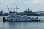
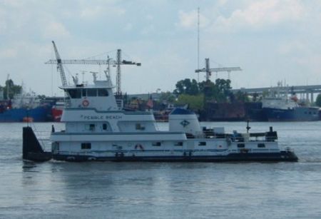
- Tug boat headed up the Mississippi.
-
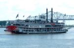
- The Natchez paddle wheeler steaming by.

-

- Carriages on the plaza by St. Louis Church.
-
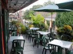
- The balcony at Sbisa, where I enjoyed a nice dinner and my first soft-shell crab.

-

- This was part of mission and one place you can get a heck of a muffaletta.

Traipsing Thru Oregon & Washington
When you’ve got a new van, you just gotta go on a road trip!
We got our 2004 Sienna in late May of that year, and in just about six weeks we pointed it north on a 1699.9-mile trip that would take us up the Oregon Coast, inland to Highway 5 and up to Sammamish. Not only a favorite spot to visit Oma and Grandpa, but just an all-around favorite spot in the Evergreen State. Being a bit optimistic about the comforts of our new vehicle, our first day was to be a long one, almost the longest. See, to get from Benicia to the California-Oregon border, you’ve got two choices. You can head up the coast on Highway 101-beautiful but a tedious road with curves a plenty. Or you take a straight shot up the well-known and well-worn Interstate 5. I-5 is fast. It cuts through rather boring farmland and grassland. A few orchards serve to break up the view, and it’s not until the last few miles before one leaves the Golden State that you start to climb up a healthy grade that leads into lower Oregon, the Siskiyou Mountains and greener vegetation.
However, we were treated to distant views of Mt. Shasta, to the right here, and even in waning days of summer, snow still covered the upper reaches of this 14,162-foot-high volcano. Quite an impressive sight, even if we are whizzing by, huh? And since this is volcano country, it wouldn’t be complete without a cinder cone apparently blocking the way. (To your left.) It’s about the time that you see these natural wonders that you begin that long climb out of California.

Lighthouse on the Oregon coast.
It seemed as if Sutherlin, which would signal our long-awaited departure from I-5 and a turn onto State Route 38 toward the coast, was unreachable during the last few hours of our drive. About now I was beginning to think my planning was too ambitious. But Route 38 is a nice drive, with lush forests and the occasional farm. In fact, it was reminiscent of our drive through the Willamette Valley and its watershed on Highway 58, during our Crater Lake-Mt. St. Helens vacation of two years ago, particularly as the highway began to parallel the Umpqua River, which empties into the ocean near Reedsport, our final destination for the day. Though we arrived late in the day, we walked down the main street (which is also Highway 101) to have dinner at a very quaint family restaurant with awesome prices. And at least the boys weren’t so tired that they couldn’t spend an hour or so in the pool and hot tub.
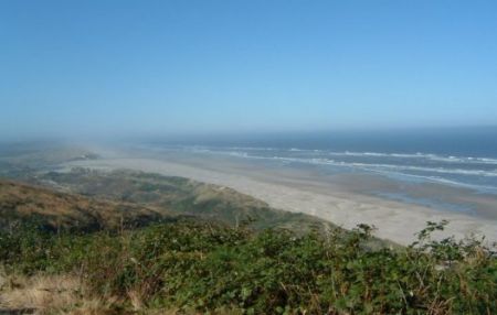
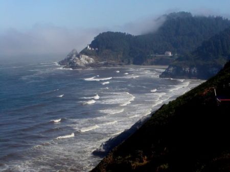
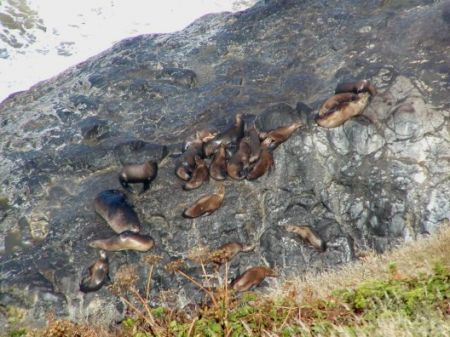
The next day we headed north on the wild and wonderful coast of Oregon. About 20 minutes later, it was time to pull off the road…at a very hazardous curve…for a visit to Sea Lion Caves. Ages ago, when I was just a little grasshopper, my family stopped here. Now it was my turn to take my family. Below, what looks like a bunch of slugs, is in fact sea lions resting outside the cave. Unfortunately, our flash wasn’t strong enough to capture an image in the cave, but I should soon post a video clip that is okay. Anyhow, if one desires to visit Sea Lion Caves, one suggestion – bring a breathing apparatus. The stink inside is pretty dreadful! But even wants to get away from the overpowering sea lion smell, the views from above and inside the cave are incredible. To the north is a lighthouse and keeper’s house, a beach extends to the south, while the Pacific Ocean stretches west. (When I was creating this page, I realized at this point that I have so many photos I would be nuts to keep up the fancy formatting, so the photos below are all related to our stop at Sea Lion Caves.)
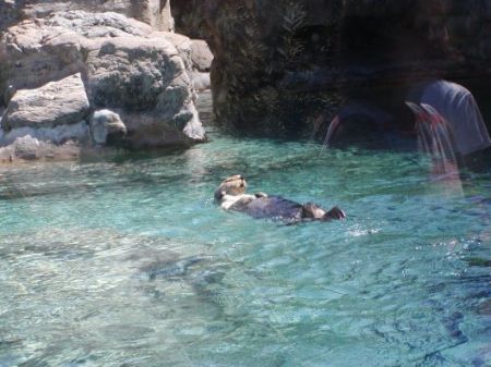
Continuing north on Highway 101, we headed for Newport and the Oregon Coast Aquarium. Though not as big as the Monterey Aquarium (in terms of shear quantity of acquariums), it is well deserving of a stop and offers a wide variety of displays that include birds and otters in addition to the fish. It was a quite well put together place, and we probably could have spent more time visiting, but rumbling tummies directed us to the town waterfront, where we dined on fresh seafood. After lunch, we watched a charter boat return with some tremendous salmon!
After our wonderful lunch in Newport, it was time for a serious leg of driving, as we headed to Tillamook. Surprisingly small town given that it is home to one of the better known cheese makers. (And a surprisingly limited number of restaurants!) We arrived later than expected, but just slipped into the Tillamook facility for a look around some cheese samples. All us boys were quite surprised at the “squeaky cheese” – it really does squeak! Though the Tillamook factory wasn’t the best tour we’ve visited, I think it’s worth a stop if you’re in the neighborhood. (The nearby Blue Heron Cheese factory is rumored to be better.)
Hindsight being what it is, I misjudged the drive from Tillamook to Astoria. It took quite a bit longer than expected, but was interrupted early in the morning with a stop at a coast-side diner. I do mean coast side…across the street (a two-lane section of Highway 101) were sand dunes that lead to the ocean. The drive out of Tillamook began smoothly enough, with mainly straight stretches, but soon closely followed the coastline, twisting and turning with every new beach, cove or river crossing. I found it to be one of the beautiful regions or Oregon, with lush greenery on the rugged coast.
I believe I had expected to arrive in Astoria (at the northwest corner of Oregon and near the mouth of the Columbia River) sometime in the early afternoon, but it was late afternoon when we finally pulled into the parking lot of the Columbia Maritime Museum. Why stop here? Well, long ago, when I was a young ‘un, we had a Time/Life series of nature and science books, one of which told of all thing related to the oceans. On one particular page was a phone of the ship to left, the Columbia Lightship. I heard that it was docked at the Columbia Martime Museum about seven years ago, and since that time told myself that I ever had the chance, I’d stop by to see it in person. No particular reason than a desire to see and touch something I read about all those years ago. It was pretty amazing, at least for me. What was perhaps more surprising was the fact that we spent almost three hours in and about the museum, with all of us finding something of interest. Another place worth stopping!
This is only the first page…come back soon for page two!
-

- Mt. Shasta on a relatively clear day.

-

- Cinder Cone

-

- Oregon Coast
-

- Lighthouse on the Oregon coast.
-

- Sea lions in Oregon.
-

- Otter at the Oregon Coast Aquarium.
-
- Puffin

-

- The Columbia Lightship, which I read about as a kid.

At the Cabin One Warm July
After months of planning before our June wedding, we weren’t much for picking up the kids and traveling too far from home. Besides, Sean and Chris for a few years had wanted an extended stay at the cabin that would allow them to play bingo at the lake, which is held every Tuesday and Thursday. This visit to the cabin included some of the best weather I have experienced in Twain Harte. Warm enough during the day for swimming, but cool enough at night to allow for a good night’s sleep. (The lack of insulation puts one at the mercy of the weather…if it’s hot during the day, it’ll be hot that night!)
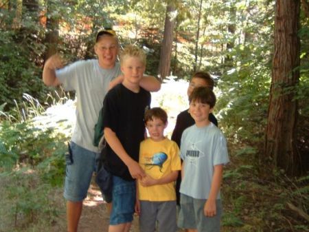
Sean, Chris, Nathan, Adam and Nicholas on the trail.
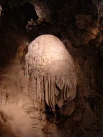
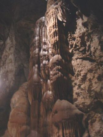
One way to escape the heat in Tuolumne County is to head underground, and there are three or four various caverns or mines within a hour’s drive or so. We headed for Moaning Cavern, just outside of Vallecito. The cavern was first discovered in approximately 1851 by miners prospecting for gold, but they didn’t have enough vision to understand tourists might offer up gold to see this natural wonder. It was rediscovered in 1919. Legend says tourists were lowered into the huge chamber in ore buckets with only the light of candles. The cavern got its name from the sound created by drops of water that fall into holes in a flowstone formation with a bottle-like shape. This drumming sound echoes throughout the cavern, and sounded like a distant moaning to early explorers.
Some Moaning Cavern statistics:
- In the cavern one can find stalactites, stalagmites, draperies and dripstones.
Large enough to contain the Statue of Liberty. - 234 stairs descend to a depth of 165 feet below ground level.
- Above-mentioned stairs were built from salvaged materials from a World War 1 battleship and was built in six months.
- Bones of prehistoric people who had fallen into the cavern thousands of years ago were found on the cavern floors.
- The cavern’s current total depth is 410 feet.
Other formations in the cavern include the “Chocolate Waterfall,” “The Meat Grinder,” “The Lasagna Factory” and “The Fruit and Vegetable Market.” Seems the early cave explorers were a bit hungry. The oddest name for a formation is probably “Godzilla’s Nostril;” though one can see it after staring for a bit.
One of the things we enjoy quite a bit while at the cabin is nearby fishing. The same irrigation ditch I mentioned earlier is also stocked with pan-sized rainbow trout (about 11-12 inches and ½-¾ pound). About a year ago we took my nephews there and lucked upon newly stocked fish, and they had a blast. Between five of us we must have pulled in 15 or so fish!
Well, figuring lighting might strike twice, Chris and I took our friends’ son to the same spot. Sure enough he hooked into a very decent size fish with a decidedly undersized pole. It was so very cool to help him reel in that first fish. And I hear that his mother enjoyed it for lunch shortly thereafter!
In between all of the above, we went swimming almost daily, hit the annual barbecue dinner at the lake on the fifth of July, visited Covers’ Apple Farm, enjoyed miniature golf, bowled (to get out of the heat) and generally just spent time as it should be when on vacation!
-

- Sean, Chris, Nathan, Adam and Nicholas on the trail.

-

- The “Brain” in Moaning Caverns.
-

- Chocolate Waterfall in Moaning Cavern.
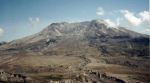
Crater Lake, Mt. St. Helens & Seattle ’02
Perhaps it was a bit ambitious, but when all was said and done and visited, our trip to Crater Lake, Mt. St. Helens and the Seattle area was a fantastic trip filled with astonishing sights (photos below). We rolled out of town with the car loaded and maps marked, on a nice summer day, though there were some worries about forest fires raging throughout California and Oregon. We whizzed through most of Northern California, then veered off well-traveled I-5 onto U.S. Route 97. A few miles after our stop in Weed, Calif., the terrain and vegetation sure changed…we drove through the dry pine forests in California at this point and entered the more lush forests of Oregon.
Then WHAM!, I slammed on the brakes shortly after passing a sign for the Klamath Fish Hatchery near Chiloquin, Oregon. The boys and I enjoyed gawking at the fish in the holding ponds, but were flabbergasted when we spied some fish that had escaped to the stream adjacent to the hatchery….one would have fed a family of fifteen! Then our adventure really began…
Driving into Crater Lake from the south is quite dramatic. We rose through the forests, glimpsing smoke from distant forest fires as we crested the occasional ridge line. We arrived at the campground about mid afternoon, but after a quick look around decided to cut our stay short by one day, allowing us a full day later at Mt. St. Helens. We set up camp, just above Annie Springs Creek, and as you may see by the picture it’s deep in a lush canyon. Adam, Sean and I hiked a trail that ran along the creek and up the hills of the canyon, stopping at the guideposts and reading from a guidebook. Of course, our visit included the boys making friends with camp neighbors and marshmallows roasted over the campfire.
The next day we struck out for “The Lake.” It’s a short drive from the campground, and on the way there we stopped at the visitor center. There the boys discovered National Park trading cards…much better than Pokémon cards if you ask me! A few minutes later we crested the rim of the former Mount Mazama. Crater Lake has to be seen to be believed…the water’s blue hues are incredible, and the picture to the left only hints at the richness of these colors. We spent quite a while walking up and down the pathways of the south rim, popping into another visitor center and the every present gift shops. Wizard Island is in the center of the lake, and on the left side on the shore line, there was some snow – at the end of July!
Of course, we had the obligatory group shot in the album. Moving from your left to right, it’s Adam, Karen with Chris sprouting out of her head, me, and Sean. Near as I can figure, the person taking the shot was leaning a bit, then I had to crop their finger out of the image, so we look as if we’re about to fall over.
The road out of Crater Lake (U.S. 97 to State Route 58) has its own charm. It’s quite a drive to reach I-5 again, but along the way you pass through a pumice desert. I thought it was an amazing sight. We passed through the Willamette Valley and watershed on Highway 58, long stands of trees and frequently the road was paralleled by a river. After this long drive (it was LONG), we stopped in Eugene at, of all places, Costco. Great place to fill up on gas and feed the kids.
The kids were incredibly well-behaved through the rest of Oregon, and we were all amazed, when we opened our doors at Seaquest State Park in Washington to the humidity that flooded in. Thank goodness we had made room to spend a full day at Mt. St. Helens, it was well worth it! After a campfire-less night (No campfires permitted in the wet woods of the Northwest?!), we left our campsite for a romp up the mountain.
Mt. St. Helens is an amazing and staggering place. Since we had all day, we drove and stopped along the way, hitting every visitor center along the way – the Mount St. Helens Visitor Center at Silver Lake, almost across the street from our campground and well worth the visit if you don’t plan on driving up to the Coldwater Visitor Center near the caldera, as we did, and Weyerhaeuser’s Mount St. Helens Forest Learning Center. At the forestry center, we spent quite a bit of time watching elk below near the riverbed.
The Coldwater Visitor Center was a fantastic place and we all enjoyed it. One of the best video presentations shows what happened through news clips and documentary footage, and at its conclusion the screen rises and curtains part to a view of Mt. St. Helens itself. (Unless it’s covered by clouds.) Later, we hiked up a vista point, where the boys “posed.” Guess we timed it just right…if you look at the picture of Mt. St. Helens above, you see nary a cloud though it was overcast until we reached the summit.
We had a great time camping our way up to the Seattle area, where we visited my folks and had a grand time, but that’s another story…and another web page.
-

- Annie Springs Creek, just down the hill from the campground.
-
- Mt. St. Helens from the visitor center.

Donner Lake ’99
August 1999 found us boys taking a chance on camping at Donner Lake. We all love the Tahoe area, but thought this less-visited campground might be a nice change of pace. And nice it was! We had our campground loop pretty much to ourselves, enjoyed fishing at Donner Lake and a pond behind the campgroud, hiked, biked, toured the visitor center and had an all-around great time. The weather was great…shorts during the day and most of the evening, as long as we warmed ’em up around the campfire. Chris and Sean are enjoying this early-evening fire, while dad, no doubt, slaves over the camp stove, perhaps frying up a freshly-caught trout.
As hinted above, we did catch fish. (Surprised?!) This was the boys’ first experience catching the ubiquitous rainbow trout. It was a great time, even if we only caught two or three fish a day. (On our return to civilization, we had the opportunity to reel in some bluegill at a friend’s pond. Way cool!)
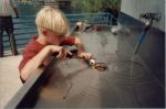
Chris even prepared our catch for dinner one night. With Chris it was not so much as cleaning the fish, but more of a dissection. After a few attempts, he was almost an expert at gutting those trout. (Next stop for Chris: an Alaskan fishing trawler!)
Of course, no visit to Donner Pass and Donner Lake would be complete without learning of the area’s history. Sean and Chris looked like ants standing at the base of the main memorial to the Donner Party. Look carefully at the photo album. The snow at the time of the Donner Party’s ill-fated trip was as deep as the top concrete edge of the statue base! The visitor centers is to what would be the right of the statue (as you are looking at it), and there’s a great self-guided trail starting at it’s back door. Well worth a visit! That’s about it…
-

- The Donner Memorial. The top edge of the stonework is at the height of the snow that stopped the Donner party.

-

- Chris caught this in a little pond behind Donner Lake.
-
- Christopher making his first attempt at cleaning a fish. Start ’em early, I say.

-

- Marshmallows and grubby boys around the campfire.
Lake Tahoe ’97
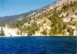
On Aug. 16, 1997 we staked our temporary claim to a campsite at Eagle Point at Emerald Bay State Park. This is probably one of the best campsites we’ve had at this campground – across from the showers, within easy walking distance of a small beach and Eagle Point, where we were able to watch ospreys feeding their young in a nest.
One of the highlights of this trip was a 1½-mile hike to Eagle Lake, and in the photos below you can that the boys were happy to make it. (Sean is hamming it up!) Guess it shows either my age or that of the boys; they pretty much kept up with me during all of our hikes throughout the area. Eagle Lake rises about 1,000 feet above the 6,229-foot elevation of Lake Tahoe, so it was a good hike. There was still snow in some of the crevices up and to the right of the rear of the lake. BTW, Eagle Lake is where part of Star Trek: Nemesis was filmed.
Our 1¼-mile hike behind Fallen Leaf Lake was also very enjoyable, though it followed what appeared to be a goat path on the side of granite mountains. And upon reaching our destination, the boys cooled off by dipping there toes into that awfully cold water.
Another highlight I would recommend that any visitor to the Tahoe area – worth the time to visit (and find) – would be Echo Lakes. Pay a measly $6 for a U.S. Forest Service tour of the two lakes. The lakes and surrounding mountains are incredibly beautiful. The two-hour tour, in an old U.S. Navy launch, takes in the natural and human history of the area. (There is a community of 100 or so seasonal homes on the shores of both lakes.)
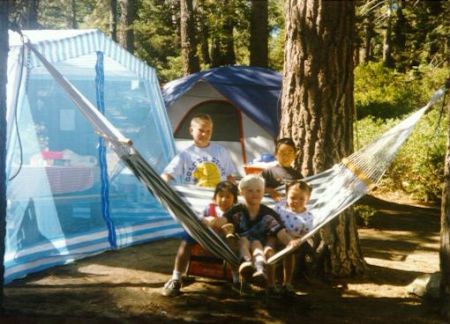
As usual, Sean and Chris made some friends (from Irvine and the city of Orange, BTW). It is nice to see some things haven’t changed in the many years I have been camping! Check the album to and another friend take a few seconds to sit still by and on the neighbor’s hammock.
If you look through the photo album, you’ll see Chris standing front of Emerald Bay. Our campsite would be just to the left of his head, on the point. The photo was taken at the top of Eagle Falls, and near the trailhead for a trail leading to Eagle Lake and other destination in the Desolation Wilderness.
-

- Our campsite at Eagle Point.

-

- The boys playing in a creek alongside the Eagle Lake trail.
-
- Christopher above Emerald Bay, somewhere along the Eagle Lake trail.

-
- We made it to Eagle Lake!

-

- Sean and Chris with their friends Gene and April, and another friend.
-
- On the Echo Leaf Lake tour.

