fishing for words

(and tossing out random thoughts)


2 Comments

averaging 58.4 mph equals one fast day

I’ve already put almost 300 miles behind me by the time the morning sun’s risen above Mt. Shasta. The gas tank’s just a bit less than half full, one of the four bottles of water is empty and the bag of jerky on the seat next to me beckons. It’s almost time for a stop.

This trip is rooted in the idea of brothers getting together at least once a year. It’s also about driving. Back when we were both underage, short impromptu road trips were about freedom, a small bit of excitement and creating memories. My ’71 Beetle was our magic carpet for many.

I-5 SignLonger trips came later. Our parents had moved to the Seattle area while I lived in the San Francisco Bay Area and, for a time, my brother lived in Southern California. The reason for our first 788-mile run to Washington has faded now but the thrill of the drive is alive and well. It took us 14½ hours. Stops were few. We ate in the car. While one was refueling the car the other would use the bathroom, then we’d switch places. There’s a lot more to that story, but that’s for another time.

Attempting this latest trip from Benicia, Calif., to Issaquah, Wash., would be an uneasy balance of reality and perception. And a promise to my wife that I’d exercise good judgement, stopping if there was even a remote possibility should it be necessary. The reality is that I’m not a spring chicken (or rooster?) anymore, but the idea I could do it myself – encouraged by the memory of that “banzai run” (my brother’s words) year ago – was enticing.

The plan was to visit the parents for a bit, then meet up with my brother for fishing, shooting, hiking and swimming; all activities of summer well suited for the last week of July. I would have no co-pilot, no flight attendant. Preparation was vital. The cooler would be loaded with two bottles of water, frozen the night before, aluminum bottle also filled with water, and two small pastrami sandwiches. (The old trick of lightly buttering the bread before slathering on condiments would prevent any sogginess.) Another aluminum water bottle sat in the cup holder. Everything would be within easy reach.

I woke up five minutes before the 4:30 a.m. alarm. It’s odd how that works – the body wakes up ready to go when the day doesn’t involve going to the office. I left the driveway a few minutes after the hoped-for 5 a.m. departure.

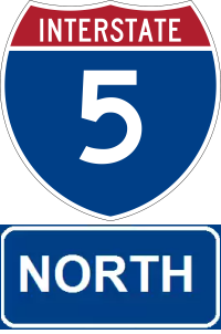
There was no competition for the fast lane. I don’t feel like I’ve made enough progress until familiar roadways are miles behind. The I-80/I-505 interchange is for me a demarcation between familiarity and mere acquaintance. Here begins long, lonely, two-lane stretches of highway that pass thirsty orchards and fields; towns that owe their existence to I-5 travelers; truck stops filled with Freightliners, Kenworths and Peterbilts (and these days Volvos); and rest areas roughly 40 miles apart. Endless power lines and aqueducts fade in and out of view.

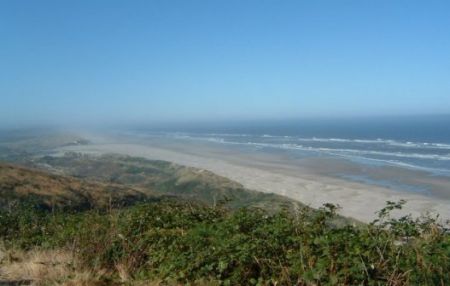
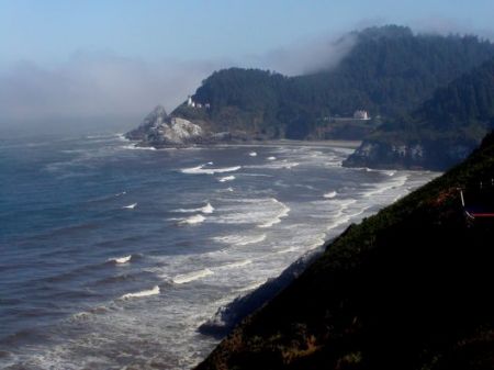
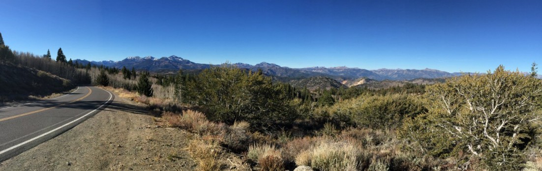
Though “The Five” parallels the Pacific coastline, it is well inland and generally manages to skirt much of the best scenery in California, Oregon and Washington. But it’s fast; choosing I-5 is all about expediency. Much of the way, the posted speed limit is 70 mph. My first stop was 258 miles later in Weed, in the shadow of Mt. Shasta and deep in the State of Jefferson. After topping off the tank and visiting the bathroom and no lingering, the climb into the Siskyou Mountains began.

The 246-mile stretch of I-5 from Weed to Eugene, through Ashland and Grants Pass, offers a welcome change: green mountains. The downside is Oregon’s low opinion of citizens’ driving skills. Speed limits drop, generally to 65 mph but often lower for brief stretches. From Eugene to Portland it’s flat, but there’s just enough variety of terrain, vegetation and crops to make it not boring, and the rest stops are more updated, or at least cleaner. Unique to this part of I-5 is the smattering of Adult Shops (that’s the name of this chain of stores) strung along the highway, which contrasts with a fair number of religious billboards that pop up south of Salem.

Oregon goes by in a blink. It takes me about the same amount of time to drive through Oregon as it did to drive from home to the northern border of California. About midway through Oregon, one sandwich is gone, the jerky bag has been opened, and I’m down to one bottle of water. I’ve listened to nine podcasts. My pace is steady. The only stops are to fill up in Salem and at rest areas as needed.

You’d think crossing the Washington border would bring a feeling of relief, but it’s a reminder that I still have about three hours to go. It’s green but monotonous, with a patchwork of farmland giving way to retail centers and too many RV dealerships. While the “Uncle Sam billboard” near Chehalis celebrates free speech, over the years I’ve found the messages to range from mildly amusing to patently offensive. The billboard also marks the long slog through never-ending construction zones and constant traffic in Olympia, and to Tacoma.

Trusting that Google knew best, I slipped off I-5 to take State Route 900, a more interesting but generally slow alternative that cuts between Cougar Mountain and Squak Mountain on its way to Issaquah. By now, a road trip playlist has replaced podcasts. It’s clear I’m moving deeper into the Evergreen state. There’s little dead space, the open areas between buildings are filled with trees and overgrown bushes and vines. I wonder if underneath it all one might find broken down trucks, discarded 55-gallon drums and other castoff debris.

Soon I’m back in familiar territory. Decades ago I lived in Issaquah for about seven months and have visited often enough to know the route. It’s not so much about landmarks – things have changed a lot in and around town – but the curve of the road and that oddly angled intersection. I debate whether to top of the gas tank and decide it can wait; any stop would delay my arrival. Finally in town, I slow for traffic. Nearly where I need to be and Washington drivers’ tendency to abide by all speed limits becomes an annoyance.

A renewed energy arises within me as I take that last right turn. I park and open the door. Glancing at the clock, I brim with smugness. My driving time was just over 13½ hours.

Sure, it’s an irrational pride to have accomplished something that means so little. But for once, I felt that I was in control of my destiny, however illusionary that might be.

Advertisement


Leave a comment

is one California too much, or how do you feel about buying multiple fishing licenses?

Though it’s a remote possibility that the proposal by Silicon Valley venture capitalist Tim Draper to divide California into six states would make it over the many required hurdles — from gathering signatures of 807,615 registered voters to put the measure on the ballot to final congressional approval — it presents a conundrum for a native Californian.

This is a big state, one of diversity. Every once and a while that diversity bubbles to the surface; one example is the Jefferson state movement that is revisited every decade or so. Boards of supervisors in Modoc and Siskiyou counties, which are near the Oregon border, approved measures in support of the Jefferson state declaration. Tehama County, one county south of Modoc and Siskiyou, has placed a similar measure on the ballot.

California is one of the few places where five major climate types can be in close proximity. From my home, it’s a four-hour drive to the high Sierras, the Humboldt redwoods or the southern coastline. The same goes with fishing: steelhead to the north, Striped bass to the east, trout to the northeast and southeast, saltwater fish to the west.

Setting aside all the pros and cons about and difficulties of creating smaller California state, it raises the possibility, just to fish for trout in place I enjoy, that I’d have to buy three separate licenses. Saltwater fishing could require a fourth. This may be an accepted part of living in smaller states, but not something I look forward to.

One upside might be the possibility that the proposed state I would live in, “North California,” could regain its water rights. I’m sure we’d set a fair price for all that water needed down south.


2 Comments

cruising to Alaska, part one: getting up steam

There are a few notable things about taking a cruise that make me feel good: massages, a disconnection from everyday demands and the fact that it’s relatively certain I’ll be part of the younger crowd. Lump in the fact that your hotel room is hauled from port to port while that someone else does the driving, often while you’re asleep, and it’s a pretty sweet deal.

Fueling this allure of cruising is the old-school mode of conveyance, a reminder of less hurried days. The big ships today don’t move any faster than their counterparts of the early 1900s.*

One has to step away from the food, onboard boutiques, entertainment and the Internet café to truly experience this timelessness of travel by ship. My wife and I found ourselves relatively undisturbed during a long, afternoon walk on a lower deck, much of that time watching the ship’s prop wash disappear over the horizon.

Leaving San Francisco Bay

We embarked in San Francisco after a short ride from home, courtesy of the in-laws. One overriding factor in choosing this longer cruise — my dear wife will tell you I wasn’t initially convinced it was worth the extra cost — was that it didn’t require violation screening by the TSA or limits on luggage…we could’ve have taken a ferry across the bay, then walked from the San Francisco Ferry Building to the cruise terminal.

Checked in and familiar with our stateroom’s location on Aloha Deck (11), we familiarized ourselves with the ship courtesy a scavenger hunt. It was helpful to my waistline that our stateroom’s location would require going up or down at least two and often four or five flights of stairs to reach most destinations.

The weather was fantastic for our departure; a bluebird sky, sunshine and wisps of clouds over the bay…at least until we got to the Golden Gate Bridge. Very little of the bridge was visible, but no matter how little of the bridge we saw, it was from a unique perspective. With the ship headed out to an overcast sea, we unpacked, settled in and prepared for dinner. My wife was most excited that evening to receive her Princess Patter, the ship newsletter, which offers a list of shipboard activity the next day and a column written by various ship’s crew.

Our first two days would be at sea, something that’d be unremarkable without knowing that I’ve been prone to seasickness. While Sea Princess — with a length of 856 feet, beam 106 feet and gross tonnage of 77,000 tons — is big ship, 11-foot swells can give a slight pitch to the deck. My apprehension faded away the morning of the second day, when I seemed to have gotten my sea legs. Even so, I still find it a bit disconcerting to jump on a treadmill in the morning to see the sea go by in a direction perpendicular to the direction you’re walking.

That second day I planned to meet with the maître d’hôtel in the morning regarding our dining arrangements. Our original reservations provided for anytime/flexible dining, but before embarking we had requested a switch to traditional dining. The first evening we were reminded that anytime dining really isn’t that flexible, not being served until well after 6:30 p.m. Apparently I made the maître d happy. My request to change to traditional dining came without caveats and with a willingness to share a table with others. Yes, my wife and I dine well with others.

We filled that second day visiting the gym, learning the ship’s layout, confirming spa appointments and attending seminars; some informative, others part of the up-selling that comes with cruising.

During a visit to the cabin in the late afternoon it was learned that I’d be wearing long pants to dinner. We had been moved to the first seating (5:30 p.m.) in the traditional dining room. We didn’t know that fate had a surprise in store.

Sunset somewhere along the California coast…

We were seated at our table, with room for six, before anyone else. Eventually, a couple sat down with their daughter and son-in-law, and introductions commenced. Shortly, however, it grew clear that they had expected another daughter and her husband to occupy the seats now filled by us. Speculation that the daughter hadn’t been able to get her dining assignment changed was soon rendered moot when she appeared, revealing that she did secure a change to traditional dining but hadn’t been able to get an assignment to their table. With a little push from my wife and I, and agreement from the head waiter, the daughter accepted our offer to switch table assignments.

We were presented to our new tablemates, among whom, as luck would have it, was a gentleman my wife had come to know on cruisecritic.com. It quickly became clear we’d all get along when John commented that had he seen us coming, he’d have said “no” to new tablemates. We’d end up spending every dinner and many evenings with John and his wife Connie, and Gene and his wife Maydean.

Our third night was a special occasion: it was the first time in years I’d worn long pants, much less a suit formal night. Adhering to tradition, it was suit and tie for the men, a dress or nice pant suit for the women. Well, some of the men and some of the women. There was a mix of attire, with tuxedoes at the top, plenty of suits, a smattering of polo shirts and khakis, and others who just should’ve order room service in. (This is one of those times that I tend to show my age, expecting that honoring a tradition means making a real effort.)

That was also the evening that we began an eight-night tradition of evening entertainment courtesy of cabaret singer/pianist Sammy Goldstein.

With an excellent start to this cruise, I was looking forward to our first stop: Ketchikan, Alaska.


* There was a contest among ocean liners to capture the trans-Atlantic speed record that led to a top speed of 43 knots (held by the SS United States), but the line is now blurred between ocean liners and cruise ships, and most maintain a cruising speed closer to 20 knots. The only ship comparable to an ocean liner of yore is Cunard Line’s Queen Mary 2, which has a top speed of 30 knots but typically cruises at 20 to 26 knots.


Leave a comment

north to Alaska…

It’s not that we’re abandoning the six regular readers out there, but three-hundred and fifty-nine days have passed since plans were laid and, finally, we’ll be cruising to Alaska just about 14 hours from now. There’s no fishing in the plans, but that’s not to say it won’t come to pass. (The Wife’s never put the kibosh on fishing and is even encouraging I do so this trip.) Regardless, there will be thoughts of fishing…in the suitcase is what’s needed to tie the flies I lose in trees use most.

It’s been a crushing week lining up the ducks. Everything’s been done that could be done at work, and whatever’s undone at home will be left that way.

Relativity being a real thing, the next 10 days will likely fly by. And human nature being what it is, I’m selfishly looking upon this as an extension of the birthday that crept up on me today. (Feel free to send any fly fishing gear, a Ferrari or cash.)

It’s not that I’m truly selfish and don’t appreciate those who spend a few seconds minutes stopping by, but don’t expect much in the coming week and a half. It’s just that there’s no guarantee that there’ll be a connection to the Interwebs or willingness to step away from the buffet or bar long enough to write.

I do promise to wave from under the Golden Gate.


Leave a comment

fishy censorship in Portland?

Portland’s Tri-County Metropolitan Transportation District of Oregon (TriMet) denied a request from Salmon for Savings, a branch of the Bring the Salmon Home Campaign, to place an ad on TriMet buses. The ad is aimed at prompting consumers to taking a look at the controversial Klamath River dams.

Sure, the salmon seem to be a bit sad-eyed, but it sure don’t seem that controversial to me. Maybe TriMet is somehow in cahoots with Pacific Power?


Leave a comment

Oregon DFW hunting for more revenue?

While I’m not one to cry “conspiracy” at the drop of a hat, maybe the
Oregon Department of fish & Wildlife has stumbled upon a novel method of raising additional funds. Seems that a new hunting and fishing license design adopted by the department this year disappears in a few weeks if placed in a plastic license holder. So far the ODFW has only issues a press release that suggests

…carrying the license…in your wallet as you would a receipt or using a paper or Tyvek license holder.

Upside for the ODFW: Oregon hunters and anglers left with a blank license will have to pay another $6.50 for a replacement.


Leave a comment

doing a rain dance

Siskiyou Summit

Siskiyou Summit

Guess I should plan to leave the state every year. Now that the five-day countdown has begun for what’s becoming a nearly annual trek northward, storms are stacking up off shore, ensuring that at the very least snow showers will plague the drive over the Siskiyous. As of today various Web cams show modest snow at the 4100- to 4300-foot elevation of Siskiyou Summit between mileposts four and five.

Funny though, that after the word “drought” has been thrown around the Golden State for months, my pending departure may bring about a remedy. Is it my leaving that brings on the weather or is Mother Nature attempting to keep me from leaving the state? Or trying to keep me out of the states to the north of the border?

Thankfully the weather forecasts show the temperatures rocketing to the low 30s…up from 15 predicted for the previous days. Here’s to hoping there’ll be no stooping in the snow to rig up the chains.


Leave a comment

Traipsing Thru Oregon & Washington

When you’ve got a new van, you just gotta go on a road trip!

We got our 2004 Sienna in late May of that year, and in just about six weeks we pointed it north on a 1699.9-mile trip that would take us up the Oregon Coast, inland to Highway 5 and up to Sammamish. Not only a favorite spot to visit Oma and Grandpa, but just an all-around favorite spot in the Evergreen State. Being a bit optimistic about the comforts of our new vehicle, our first day was to be a long one, almost the longest. See, to get from Benicia to the California-Oregon border, you’ve got two choices. You can head up the coast on Highway 101-beautiful but a tedious road with curves a plenty. Or you take a straight shot up the well-known and well-worn Interstate 5. I-5 is fast. It cuts through rather boring farmland and grassland. A few orchards serve to break up the view, and it’s not until the last few miles before one leaves the Golden State that you start to climb up a healthy grade that leads into lower Oregon, the Siskiyou Mountains and greener vegetation.

However, we were treated to distant views of Mt. Shasta, to the right here, and even in waning days of summer, snow still covered the upper reaches of this 14,162-foot-high volcano. Quite an impressive sight, even if we are whizzing by, huh? And since this is volcano country, it wouldn’t be complete without a cinder cone apparently blocking the way. (To your left.) It’s about the time that you see these natural wonders that you begin that long climb out of California.

Lighthouse

Lighthouse on the Oregon coast.

It seemed as if Sutherlin, which would signal our long-awaited departure from I-5 and a turn onto State Route 38 toward the coast, was unreachable during the last few hours of our drive. About now I was beginning to think my planning was too ambitious. But Route 38 is a nice drive, with lush forests and the occasional farm. In fact, it was reminiscent of our drive through the Willamette Valley and its watershed on Highway 58, during our Crater Lake-Mt. St. Helens vacation of two years ago, particularly as the highway began to parallel the Umpqua River, which empties into the ocean near Reedsport, our final destination for the day. Though we arrived late in the day, we walked down the main street (which is also Highway 101) to have dinner at a very quaint family restaurant with awesome prices. And at least the boys weren’t so tired that they couldn’t spend an hour or so in the pool and hot tub.

The next day we headed north on the wild and wonderful coast of Oregon. About 20 minutes later, it was time to pull off the road…at a very hazardous curve…for a visit to Sea Lion Caves. Ages ago, when I was just a little grasshopper, my family stopped here. Now it was my turn to take my family. Below, what looks like a bunch of slugs, is in fact sea lions resting outside the cave. Unfortunately, our flash wasn’t strong enough to capture an image in the cave, but I should soon post a video clip that is okay. Anyhow, if one desires to visit Sea Lion Caves, one suggestion – bring a breathing apparatus. The stink inside is pretty dreadful! But even wants to get away from the overpowering sea lion smell, the views from above and inside the cave are incredible. To the north is a lighthouse and keeper’s house, a beach extends to the south, while the Pacific Ocean stretches west. (When I was creating this page, I realized at this point that I have so many photos I would be nuts to keep up the fancy formatting, so the photos below are all related to our stop at Sea Lion Caves.)

Continuing north on Highway 101, we headed for Newport and the Oregon Coast Aquarium. Though not as big as the Monterey Aquarium (in terms of shear quantity of acquariums), it is well deserving of a stop and offers a wide variety of displays that include birds and otters in addition to the fish. It was a quite well put together place, and we probably could have spent more time visiting, but rumbling tummies directed us to the town waterfront, where we dined on fresh seafood. After lunch, we watched a charter boat return with some tremendous salmon!

After our wonderful lunch in Newport, it was time for a serious leg of driving, as we headed to Tillamook. Surprisingly small town given that it is home to one of the better known cheese makers. (And a surprisingly limited number of restaurants!) We arrived later than expected, but just slipped into the Tillamook facility for a look around some cheese samples. All us boys were quite surprised at the “squeaky cheese” – it really does squeak! Though the Tillamook factory wasn’t the best tour we’ve visited, I think it’s worth a stop if you’re in the neighborhood. (The nearby Blue Heron Cheese factory is rumored to be better.)

Hindsight being what it is, I misjudged the drive from Tillamook to Astoria. It took quite a bit longer than expected, but was interrupted early in the morning with a stop at a coast-side diner. I do mean coast side…across the street (a two-lane section of Highway 101) were sand dunes that lead to the ocean. The drive out of Tillamook began smoothly enough, with mainly straight stretches, but soon closely followed the coastline, twisting and turning with every new beach, cove or river crossing. I found it to be one of the beautiful regions or Oregon, with lush greenery on the rugged coast.

I believe I had expected to arrive in Astoria (at the northwest corner of Oregon and near the mouth of the Columbia River) sometime in the early afternoon, but it was late afternoon when we finally pulled into the parking lot of the Columbia Maritime Museum. Why stop here? Well, long ago, when I was a young ‘un, we had a Time/Life series of nature and science books, one of which told of all thing related to the oceans. On one particular page was a phone of the ship to left, the Columbia Lightship. I heard that it was docked at the Columbia Martime Museum about seven years ago, and since that time told myself that I ever had the chance, I’d stop by to see it in person. No particular reason than a desire to see and touch something I read about all those years ago. It was pretty amazing, at least for me. What was perhaps more surprising was the fact that we spent almost three hours in and about the museum, with all of us finding something of interest. Another place worth stopping!

This is only the first page…come back soon for page two!


Leave a comment

Crater Lake, Mt. St. Helens & Seattle ’02

Perhaps it was a bit ambitious, but when all was said and done and visited, our trip to Crater Lake, Mt. St. Helens and the Seattle area was a fantastic trip filled with astonishing sights (photos below). We rolled out of town with the car loaded and maps marked, on a nice summer day, though there were some worries about forest fires raging throughout California and Oregon. We whizzed through most of Northern California, then veered off well-traveled I-5 onto U.S. Route 97. A few miles after our stop in Weed, Calif., the terrain and vegetation sure changed…we drove through the dry pine forests in California at this point and entered the more lush forests of Oregon.

Then WHAM!, I slammed on the brakes shortly after passing a sign for the Klamath Fish Hatchery near Chiloquin, Oregon. The boys and I enjoyed gawking at the fish in the holding ponds, but were flabbergasted when we spied some fish that had escaped to the stream adjacent to the hatchery….one would have fed a family of fifteen! Then our adventure really began…

Driving into Crater Lake from the south is quite dramatic. We rose through the forests, glimpsing smoke from distant forest fires as we crested the occasional ridge line. We arrived at the campground about mid afternoon, but after a quick look around decided to cut our stay short by one day, allowing us a full day later at Mt. St. Helens. We set up camp, just above Annie Springs Creek, and as you may see by the picture it’s deep in a lush canyon. Adam, Sean and I hiked a trail that ran along the creek and up the hills of the canyon, stopping at the guideposts and reading from a guidebook. Of course, our visit included the boys making friends with camp neighbors and marshmallows roasted over the campfire.

The next day we struck out for “The Lake.” It’s a short drive from the campground, and on the way there we stopped at the visitor center. There the boys discovered National Park trading cards…much better than Pokémon cards if you ask me! A few minutes later we crested the rim of the former Mount Mazama. Crater Lake has to be seen to be believed…the water’s blue hues are incredible, and the picture to the left only hints at the richness of these colors. We spent quite a while walking up and down the pathways of the south rim, popping into another visitor center and the every present gift shops.  Wizard Island is in the center of the lake, and on the left side on the shore line, there was some snow – at the end of July!

Of course, we had the obligatory group shot in the album. Moving from your left to right, it’s Adam, Karen with Chris sprouting out of her head, me, and Sean. Near as I can figure, the person taking the shot was leaning a bit, then I had to crop their finger out of the image, so we look as if we’re about to fall over.

The road out of Crater Lake (U.S. 97 to State Route 58) has its own charm. It’s quite a drive to reach I-5 again, but along the way you pass through a pumice desert. I thought it was an amazing sight. We passed through the Willamette Valley and watershed on Highway 58, long stands of trees and frequently the road was paralleled by a river. After this long drive (it was LONG), we stopped in Eugene at, of all places, Costco. Great place to fill up on gas and feed the kids.

The kids were incredibly well-behaved through the rest of Oregon, and we were all amazed, when we opened our doors at Seaquest State Park in Washington to the humidity that flooded in. Thank goodness we had made room to spend a full day at Mt. St. Helens, it was well worth it! After a campfire-less night (No campfires permitted in the wet woods of the Northwest?!), we left our campsite for a romp up the mountain.

Mt. St. Helens is an amazing and staggering place. Since we had all day, we drove and stopped along the way, hitting every visitor center along the way – the Mount St. Helens Visitor Center at Silver Lake, almost across the street from our campground and well worth the visit if you don’t plan on driving up to the Coldwater Visitor Center near the caldera, as we did, and Weyerhaeuser’s Mount St. Helens Forest Learning Center. At the forestry center, we spent quite a bit of time watching elk below near the riverbed.

The Coldwater Visitor Center was a fantastic place and we all enjoyed it. One of the best video presentations shows what happened through news clips and documentary footage, and at its conclusion the screen rises and curtains part to a view of Mt. St. Helens itself. (Unless it’s covered by clouds.) Later, we hiked up a vista point, where the boys “posed.” Guess we timed it just right…if you look at the picture of Mt. St. Helens above, you see nary a cloud though it was overcast until we reached the summit.

We had a great time camping our way up to the Seattle area, where we visited my folks and had a grand time, but that’s another story…and another web page.