fishing for words

(and tossing out random thoughts)


2 Comments

plenty of water and willing fish, and a return to Crooked Creek, part three

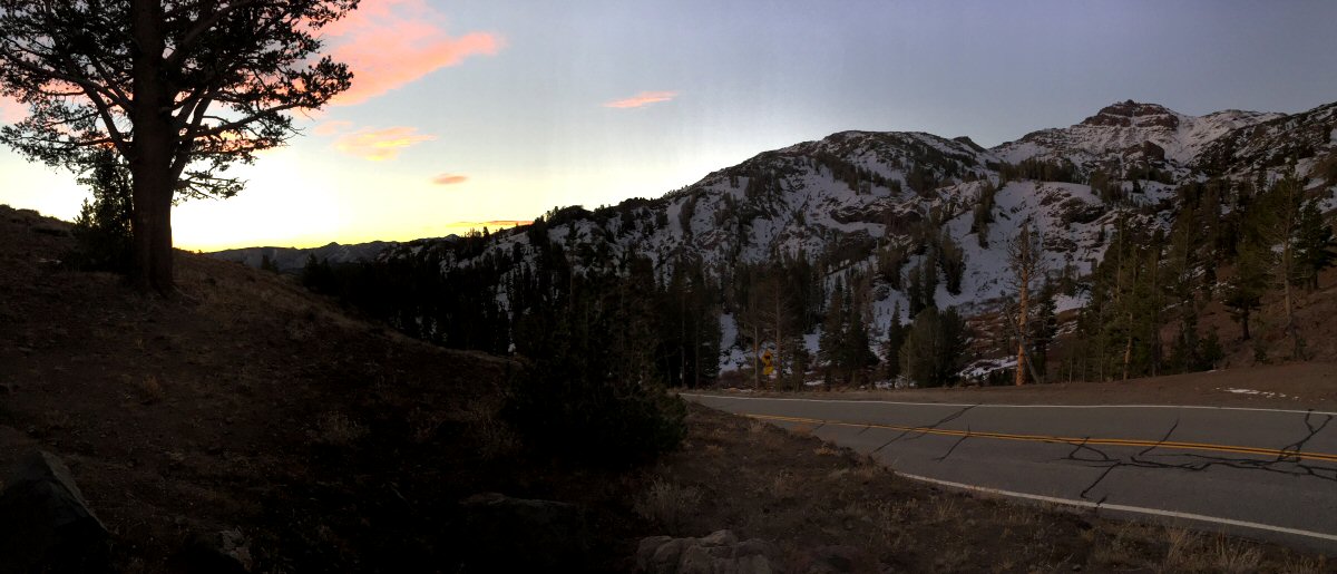
It’s a good thing that the shoreline of Crowley Lake isn’t much to look at; indicators go down the moment one looks away.

Looking down at Crowley Lake from the west, toward Nevada.

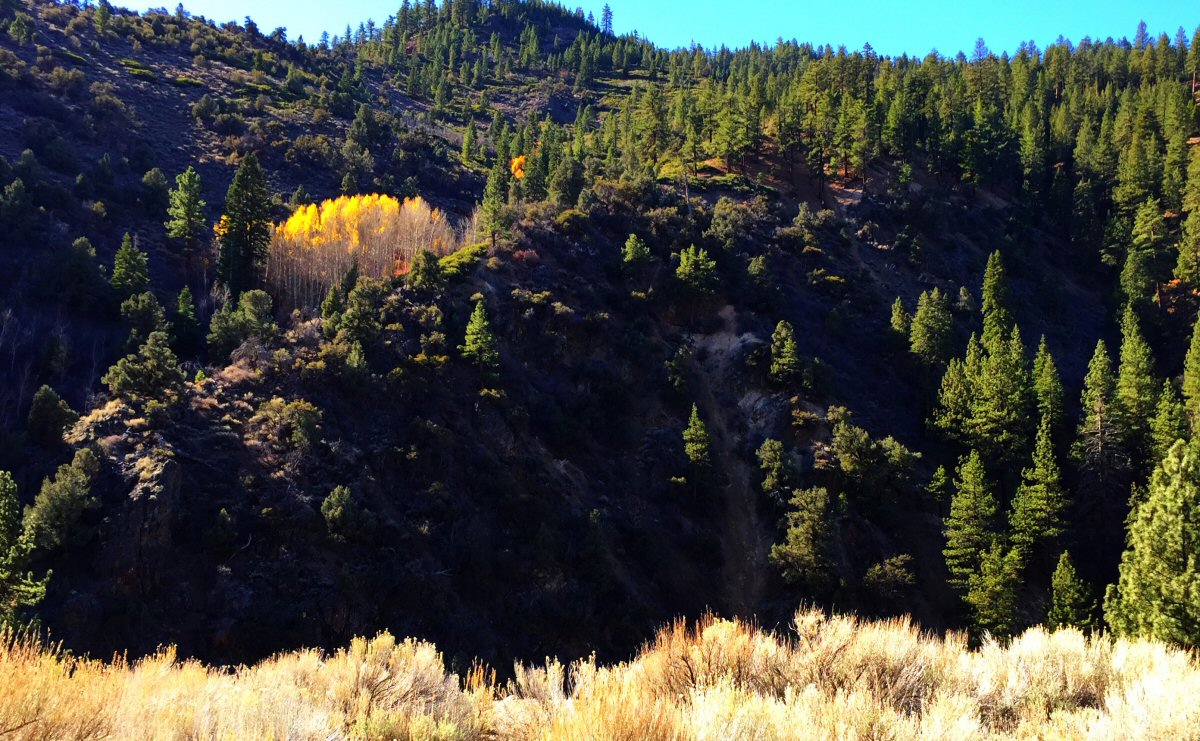
Nested in the south end of the Long Valley Caldera, Crowley Lake is a reservoir turned model trout fishery. Created by the damming of the Owens River just before the Owens River George, the lake sits at 6,800 feet and cool during the summer but doesn’t fully freeze during the winter. With a pH on the alkaline side and feed by a confluence of snowmelt-fed creeks – the Upper Owens River and McGee, Convict, Hilton, and Crooked creeks – and underwater springs, it offers a near-perfect mix of abundant oxygen and nutrients to sustain a robust population of aquatic insects, dominated by an incredible number of chironomids. The addition of Sacramento perch offers fry to feed big trout.

Whenever on this trip, I put out a call for partners to share the cost of a guide boat. While stillwater nymphing may not be a tactic favored by all, it’s unfair to dismiss it without trying it, at least once. Like guided fly fishing on any boat I’ve been, it’s like stepping onto a cruise ship. Just bring yourself, your license and sunscreen.

Gerry was the first to respond to my query and we set up a trip with Joe Contaldi. The owner of Performance Anglers Guide Service, he’s well-known on the fly fishing club speaking circuit and possesses the qualities that make for a great guide: enthusiasm, knowledge, and skill.

We arrive at the marine just before its 7 a.m. opening. We watch in disgust as an angler, two trucks ahead of us, strips all of the monofilament off his spinning road and leaves it lying on the road. The gate opens and we pull up, stopping long enough for Gerry to open the passenger door and grab the line.

It’s busy around the boat ramp as we walk toward the docks. After quick hello to Doug Rodricks, who I’ve fished with before on Crowley and Eagle lakes, we find Joe and his boat. Joe’s got that lake guide look, weatherworn, clear eyes, and a natural penchant for enthusiastic encouragement. He welcomes us aboard, offers massive and unexpected muffins for breakfast, then readies the boat for a short run north to McGee Bay.

It’s calm this morning on the lake; it’s a liquid mirror reflecting the mountains and sky. Beautiful, but not my favorite conditions. My best days fishing Crowley were helped by a little ripple on the water, just enough wave action to keep the fly moving and enticing hits a dozen feet under the surface. Gerry and I are instructed to occasionally raise our rod tips to give the flies action, a tactic with which we’re both familiar.

We anchor, rig up, and Joe points out the lane we should target. It’s a drop off twenty to twenty-five feet from the boat. I settle in, reacquainting myself with the lake, like meeting up with a friend after a long absence. It’s not long before there’s confirmation of fish in the area, on other boats. The still morning air is broken now and again by shouts of “fish on,” sometimes followed by the noises of anguish when a fish doesn’t make to the net.

Stillwater nymphing on Crowley Lake requires patience, focus, knowledge, and hope. I could on a guide for the knowledge, then hope I’m fast enough to set the hook. It’s the focus on the indicator, quickly followed by a quick and smooth hookset that’ll factor into success. Sometimes it takes a few misses to reacquire that skillset. Less than an hour after anchoring, that skillset was reacquired.

It’d be nice to say that I hit that first strike and landed a fish, but I can’t exactly remember. Regardless, that first fish was more than nice sized, about eighteen-plus inches. Joe asks if I wanted a photo with it, but I opt to wait for a bigger trout.

Fish on for Gerry in the early and too calm morning.

There can be days on Crowley Lake when the fishing is fast and furious, or consistent, or tough. This would be a day of consistency, both in terms of frequency and size. There was a chance nearly every half hour to hook a fish. A chance that required we consistently perform good hooksets. Sadly but honestly I must say my hooksets were less consistent than the bite.

The fish we did bring to net were consistently impressive. About midmorning , Gerry and I had a double. We both landed fish nearly every hour until about 11 a.m. When the bite slowed, I dug into lunch, a ritual that often elicits strikes. It didn’t.

One of my first Lahanton Cutthroats of the day.

Gerry’s big Lahanton, out of McGee Bay.

This is the time of day when guides decide whether to hold out for better fishing or to explore other options. Friend and outing companion Wayne and his guest, Project Healing Waters Fly Fishing participant Mike, were on the move, their guide on the hunt for a better spot. Joe asked us if we wanted to pull up anchor, suggesting we might try the Crooked Creek arm. Despite uninspiring reports from other guides, I said I was willing to give it a try.

(Crooked Creek was where I first learned stillwater nymphing. During April 2007, son Christopher and I attended the DVFF’s Novice Fly Fishing Seminar and, inspired by the class, sought a real-world experience reinforce what we had learned and expand out skillset with the help of a guide. I booked a trip on the hitherto mysterious Crowley Lake. When I was a kid, my family and I would pass the lake on the way to Tuolumne Meadows or June Lake Loop. The local newspapers we’d pick up to read and use in starting campfires were peppered with photos of unbelievably large trouts.)

Wayne and Mike headed out in search of fish.

Joe spent extra time positioning the boat mid channel and the first 10 minutes didn’t inspire confidence that this had been the right move. With my attention span waning, I missed the first solid takedown. But consistent opportunities that afternoon allowed Gerry and me to hook, fight, and land some of the most exciting fish of the day.

That evening, without embellishment, we dutifully made a report to our club colleagues. Perhaps our only complaint were sore cheeks from the constant grinning.

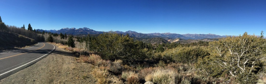
The next morning coffee was on early and a coordinated effort ensured the cabins were quickly cleaned. After a final group photo, some would make one last stop to wet a line. I chose to take my time through Yosemite, lingering to enjoy time well spent in beautiful places.


For those who missed ’em: Part One and Part Two.

Advertisement


6 Comments

National Parks Week and appreciating a high-country home

Centennial-Logo-W-Find-Your-Park-LogoOur days were measured by trout caught, bears seen and miles hiked; nights by stars and the embers of a campfire. During those summers we’d rarely see a familiar face, but the place seemed unchanging. We grew a lot during those short visits, climbing granite domes, hiking trails commonly rising 1,000 feet in less than five miles, floating in a river that only a few miles earlier was born of snowmelt.

I was reminded that Tuolumne Meadows was our vacation “home” last week when I posted a photo of my brother and me with a trophy high-country trout, back when our fishing was more about self-sufficiency and every fish ended up in a pan surrounded by bacon. Mornings my brother, sister and I would hike to Soda Springs to capture the naturally carbonated water – and bits of minerals I’m sure – our mother would gently blend with pancake mix to make some of the puffiest pancakes in the world.

Our visits to Tuolumne Meadows were more adventure than vacation. Stories of our exploits of those summers come up frequently: The poor decision to slide down the granite face of Lembert Dome as the sun set. The bear that followed us back to camp after a long day hike. My sister’s discovery that fish were living beings while ironically still fishing but refusing to eat our catch. On tougher hikes, mom’s constant encouragement to discover what might be around the next bend.

TM-Mark and meIt wouldn’t be out of place to say that Tuolumne Meadows, a less visited part of Yosemite National Park, helped form the person I am today. I’ve since returned to Tuolumne Meadows, one time fishing there with my sons, another time hiking up Lembert Dome with my brother and one son. Nature seems to ignore us humans; the changes over the last three decades are entirely ours.

I’ve been lucky enough to have visited Death Valley, Sequoia & Kings Canyon, Lassen, Redwood and Mt. St. Helen national parks. Many national monuments, recreation areas and historic sites as well: Alcatraz Island, John Muir National Historic Site, Point Reyes National Seashore, Muir Woods National Monument, Cabrillo National Monument, Fort Point National Historic Site and Golden Gate Recreation Area.

The national park system is America’s Best Idea. Next week is National Park Week. Every national park will offer free admission from April 16th through the 24th. If you can, get to one and #FindYourPark.

“Thousands of tired, nerve-shaken, over-civilized people are beginning to find out that going to the mountains is going home; that wildness is a necessity”
― John Muir, Our National Parks


1 Comment

exploring before it’s all over

As if it hasn’t been a figuratively dry trout season for me, a long trip last weekend over three passes, along rivers and over two reservoirs showed that things are literally drying up…

This was my last and only second trip to the Sierras during the general trout season. It was happenstance that kept me off the water and only sheer determination — and a desperate desire for a break from every-day life — that crammed a 400-plus mile drive and not enough fishing into a single day.

Firsthand reports dashed any hope of great fishing. Small streams were trickles, meaning wild fish were off limits. State-stocked waters that normally received a few buckets of fish before the end of the season didn’t.

Another view of the sunrise from Sonora Pass.

Another view of the sunrise from Sonora Pass.

Optimism being the most overused tool in a fly fisherman’s arsenal, I still hit the road over Sonora Pass before sunup. If there were few fish to be had, at least a sunrise at 9,000 feet doesn’t disappoint. This late in the year, a sunrise seems to last longer.

Looking a bit southwest from Sonora Pass.

Looking a bit southwest from Sonora Pass.

There was unexpected company on the West Walker River, a couple planning to soak bait. They went their way, I went mine. I’d have pocket water all to myself, whitefish on the mind, and the sound of reveille arising (a bit too late in the morning this time?) from the Marine Corps Mountain Warfare Training Center.

My "office" for the morning. (West Walker River)

My “office” for the morning. (West Walker River)

Just like that “confidence fly” most fly fishermen keep tucked away, there are pieces of water one comes to expect to hold fish. My expectation held true this morning. It didn’t take long before a fish was fooled with my favorite red-butt zebra midge pattern. While not large, white tips on smooth fins suggested it was a more educated trout. Even if was a hatchery fish, it had spent enough time in the wild to learn a few things while it’s pectoral and caudal fins healed. There would be no whitefish this year and nothing big, but all of the trout I found were feisty.

This isn’t the time of year that these trout rise to dry flies, but the water level requires stealth, a dry-dropper setup, light casts to small seams and short drifts. It’s hard to disagree that this type of rig might be a reflection of my middle-of-the-road nature, mixing the oft-look’d-down-upon tactic of nymphing with the loftier technique of dry fly fishing. Deep down I hoped for a rise to the dry fly, but ice crunching underfoot suggested it was not to be.

My plans called for crossing Monitor Pass on the way to the East Carson River, then over Ebbetts Pass, and finally completing a twisting and oblong course over the man-made New Melones Lake. Unfamiliar with the route and wary of unpredictable delays, I was on the road again before noon.

Many times I’ve enjoyed driving — whether a car or motorcycle — over Tioga and Sonora passes many times, during the spring, summer and fall. Any threat of snow brings about closures, but during this trip Tioga and Sonora pass, as well as Ebbetts and Monitor pass had reopened after brief snow closures earlier in the week.

Looking west from near Monitor Pass.

Looking west from near Monitor Pass.

The landscape and vegetation of each pass is unique, with stark changes as one gains elevation. Over Monitor Pass, Highway 89 twists between and over numerous peaks, alternating between barren high desert to east and the fir and pine forests on the western slopes. Once over the summit, the road quickly descends to meet Highway 4, then crosses the East Carson River.

This was first visit to the East Carson River. The wild trout section was low and slow, and out of the shadows of the high canyon walls. Sunlight reflected off nearly every eddy, riffle and pool, and, as might be expected, the fishing was great but the catching not. It was suggested after the fact that I should have fished upstream, where a summer of stocking might mean a few stupid willing fish would remain. I chalked this visit up to exploration. Since it wasn’t too far away, I drove to Markleeville. I had to drive through town a second time; I blinked and missed it the first time through.

Colors along Highway 89, just south of the East Carson River.

Colors along Highway 89, just south of the East Carson River.

The route over Ebbetts Pass is more adventurous than the comparatively high-speed Highway 108 over Sonora Pass and Highway 120, which winds through Yosemite and over Tioga Pass.

Driving over Ebbetts Pass is not for the faint of heart. Sandwiched between a full-width, two-lane state highway is a section reminiscent of the descriptions our parents and grandparents might offer of roads built only wide enough that two Model Ts could squeeze by each other. This middle section, from Lake Alpine to Silver Creek, is a barely two-lane road. There is no center line or fog lines. Shoulders are a rarity. Steep curvy portions, precipitous drop-offs and vistas of pristine landscapes are plentiful. If the narrowness of this road isn’t enough to reduce one’s speed, the beauty was. Lack of planning meant I couldn’t linger. Plans are already afoot to return with a greater abundance of time.

Ebbetts Pass tarn.

Ebbetts Pass tarn.

The rest of my drive was in relatively civilized areas. I’d pick up apple cider outside of Arnold, then wine and special spices in Murphys. I crossed New Melones Lake, which looked more a river at flood stage (it was formed by the damming of the Stanislaus River). Back in Twain Harte early, I cleaned up and planned to attend to a few items on the to-do list, figuring I’d walk to the local Ace store for a halogen bulb and any other necessary item. During the walk I began an exploration of a different variety. More on that next time my fingers are willing to dance on the keyboard…

Leavitt Falls, late in the fall.

Leavitt Falls, late in the fall.

All of the photos, and some more:


Leave a comment

is one California too much, or how do you feel about buying multiple fishing licenses?

Though it’s a remote possibility that the proposal by Silicon Valley venture capitalist Tim Draper to divide California into six states would make it over the many required hurdles — from gathering signatures of 807,615 registered voters to put the measure on the ballot to final congressional approval — it presents a conundrum for a native Californian.

This is a big state, one of diversity. Every once and a while that diversity bubbles to the surface; one example is the Jefferson state movement that is revisited every decade or so. Boards of supervisors in Modoc and Siskiyou counties, which are near the Oregon border, approved measures in support of the Jefferson state declaration. Tehama County, one county south of Modoc and Siskiyou, has placed a similar measure on the ballot.

California is one of the few places where five major climate types can be in close proximity. From my home, it’s a four-hour drive to the high Sierras, the Humboldt redwoods or the southern coastline. The same goes with fishing: steelhead to the north, Striped bass to the east, trout to the northeast and southeast, saltwater fish to the west.

Setting aside all the pros and cons about and difficulties of creating smaller California state, it raises the possibility, just to fish for trout in place I enjoy, that I’d have to buy three separate licenses. Saltwater fishing could require a fourth. This may be an accepted part of living in smaller states, but not something I look forward to.

One upside might be the possibility that the proposed state I would live in, “North California,” could regain its water rights. I’m sure we’d set a fair price for all that water needed down south.


Leave a comment

don’t know what to expect this trip

It’s been a bad year for water in California. The April opener was one of the best in years thanks to low water levels.

Next week we’ll see for ourselves what Eastern Sierra rivers and lakes look like four months later.

One guide recently referred to Bridgeport Reservoir as a “pond.” Bridgeport is so low that its outflow into the East Walker River has been tainted by algae — algae that usually floats closer to the surface of the reservoir — and now the river is regularly off color and weedier than usual. Lake Sabrina in the Bishop area is so low that the front (manmade) lake no longer exists. The level of Crowley Lake is better than might be expected, but low enough to concentrate fish in the deepest areas.

The route taken by myself and guys from the club will be dictated by the Rim Fire. Hwy 120 remains closed. An expectation that the fire might not be fully contained until Sept. 20 doesn’t lend any clarity as to when it might open.

That’s not a big issue for me. I usually head over Sonora Pass via Hwy 108, with stops at the West Walker River, Little Walker River or Molybdenite Creek.

Thankfully, there will be water to fish when we settle in at Tom’s Place Resort (which certainly isn’t the resort you might think it is). The Upper Owens is supposed to be in good shape. The Middle Owens is flowing at an unseasonably high level. I may head to the high country, visiting alpine lakes and streams where I hope the fish are already preparing for a long winter.

However it works out, there will be lies told over beer and good grub.


2 Comments

on the Rim Fire (and why it might be better find other places to fish, for now, and let nature heal, undisturbed)

It was long ago decided that this blog was to be guided by a few simple rules; that it would be family focused and friendly, devoid of rants or advice, and mostly my space to write about the misadventures of my life.

Today, however, things are bit somber.

CalFire Rim Fire Incident Report

CalFire Rim Fire Incident Report

California’s fire season is shaping up to be one of historic proportions. The Rim Fire still raging near Yosemite Valley is one of 11 major fires currently burning in our bone-dry state. Those are only “major” fires. During the last few weeks, about 150 fires were sparked by lightning strikes. CalFire figures show that through the middle of August, 4,715 separate fires have burned the state — beating by a wide margin the historical annual average since 2008 of 3,000 fires. The Rim Fire is now the largest fire in the recorded history of the Sierra Nevada and, as of today, the 5th largest wildfire in California’s history.

In this moment, all eyes are understandably on the immediate danger to lives and property. Prayers are being said for the firefighters. This is devastation on an unimaginable scale.

As a fly fisherman, I can’t help but ask questions about the long-term impact on the many streams and rivers now stripped of bankside vegetation, and the fish in their waters. The extent of ecological damage won’t be understood for a long time. The intensity of the blaze — flames reportedly reached 100 to 200 feet as they shot up canyons — left nothing behind. While the Groveland Ranger District of the Stanislaus National Forest, the area predominately affected by the Rim Fire, has gone through cycles of intense wildfires, those fires have burned only small areas. (Decades of fire suppression and logging can be blamed.) Conjecture is that the Rim Fire, however, may have denuded up to a 1,000 acres.

The northern edge of the Rim Fire crossed the Clavey River, one of the longest undammed rivers in the Sierra Nevada, a designated wild and scenic river, and home to native coastal rainbow trout. The fire burned along extended stretches of the South and Middle Fork of the Tuolumne River as well as Cherry Creek, all waters known for fishing, whether stocked or wild fish. Many other but lesser known streams, streams I’ve found wild populations of trout, also fall within the boundaries of the Rim Fire.

The Clavey River

The Clavey River

Relatively little is known about the effect of fire on fish populations. An admittedly hasty search of the Internet offers some insight. It’s clear that the effects of fire on fish populations can be complex, with dependency on the length of the event, size of the habitat, the home range of the fish, specialization of spawning habitats and the type of fish. Of course, most studies cite salmonid fishes (trout, salmon, chars, freshwater whitefishes and grayling) as the taxonomic group slowest to recover after a fire.

That said, the effect of fire on native salmonid populations can be highly variable, with extinctions observed in some isolated small headwater streams, but a quick rebound when a species’ home range extends to multiple tributaries within a single watershed.

In affected rivers, streams and lakes, fires can most notably affect water temperature and water chemistry as well as the local invertebrates, amphibians and fish. No longer shaded by trees and brush, water temperature can rise, reducing the solubility of dissolved oxygen. Absorption of ash can increase the water’s pH and impact nutrient levels in aquatic systems. Studies document five- to 60-fold increases in phosphate, nitrate, and ammonium concentrations in streams affected by fires that have swept through larger watersheds. Conditions in these waters returned to normal with a few weeks, but were later impacted by rain flushing additional ash and soil through the watershed.

It’s likely that the smallest streams will have most dramatically impacted by the fire. Though most people dance around the issue, this has been another drought year for California, and water levels are so low that any longish exposure to the fire may have “cooked” many of those small streams.

Nature, however, can be resilient; as long as we don’t get in the way. Anyone who’s visited Mt. St. Helens National Volcanic Monument can attest to that.

A beetle native to the Sierras, which has infrared receptors allowing it to detect fire, could be first on scene to feast on the blackened trees. They, in turn, will draw birds. New growth will sprout, creating forage for small mammals and, eventually, deer and bears.

It just takes time. Though it may not look the same.

For a while, though, many Tuolumne County fisheries will probably be best left alone.


Leave a comment

you may have to carry a fire extinguisher to hike high enough to find Sierra Nevada trout

ICCC Report CoverFollowing up its good news/bad news report on Lake Tahoe, the California Office of Environmental Health Hazard Assessment paints a bleaker picture in its August 2013 Indicators of Climate Change in California.

To sum it up, analysis of monitoring data and scientific research from throughout the state outlines the effects of climate change: The spring runoff in the Sierra Nevada has declined over the last century. The period of time when winter temperatures in the Central Valley are cold enough for the development of fruit and nut tree flowers has been decreasing since 1950. River runoff declined during the 20th Century:

River Runoff Percent Decline
in 20th Century
Sacramento River System* 9%
San Joaquin River System 6%
Kings River 6%
Kern River 8%
Mokelumne River 7%
Trinity River 8%
Truckee River 13%
Carson and Walker rivers 5%
*includes the Sacramento River and major tributaries, the Feather, Yuba and American rivers.

Changes in average temperatures have led to die-offs of native vegetation at the lower range of various species’ elevation range (during the last six decades Sierra Nevada conifers have clearly retreated upslope) and is pushing about half of the small mammals in Yosemite National Park to higher elevations. The annual acreage burned by wildfires in the state increased since 1950, with the three largest fire years occurring during the last 10 years. The acidity in the coastal waters around Monterey Bay is increasing at a rate greater than that in the open ocean near Hawaii. The average annual temperature in mountain lakes, including Lake Tahoe, has risen over the last few decades.

And butterflies are emerging earlier during the spring in the Central Valley.

Yet, there’s no real trend that can be discerned from the data. The rise in the sea level rise along the California coast is bucked the global pattern and has be relatively constant during the last two decades.

Cheery stuff.


3 Comments

grinding the nose in between what really matters

“We’ve been busy…” would be the applicable excuse to explain the lack of posts here, and it’s true in more than one way. The nose has certainly been to the grindstone, but thankfully interrupted by (multiple) visits from out-of-state family rarely seen south of the 47th parallel, too much food, copious beer tasting, and the celebration of one of those big steps down the path of life. The yard lies ignored.

Another road trip begins in just over 24 hours, an annual trek that’ll put us in the middle of a pretty fishy — and pretty — spot east and a smidge south of Yosemite. We’ve fished there before quite a few times, but this year, conditions seem to be a couple weeks ahead; more of what might be expected later in the month. The upside is that a small river not visited before may be a prime candidate this year.

At any rate, life’s been good lately, and now that we’re on the downhill slide into the holidays it’s hard to believe another year is closing fast.


2 Comments

(relatively) word-free Friday

Since pictures are worth a thousand words, and it would take many thousands to tell of the adventure and fun enjoyed last week with my brother’s family, below is a gallery of photos that tell the story than I could. The days were filled with swimming at the local lake, visiting a historic gold rush town and panning for gold, more fun — swimming, sliding, diving, building sand castles — at the lake, hiking, mini golf and a trip to Yosemite. Enjoy!

Due to loading issues, the gallery has been moved here.


Leave a comment

a return to the high country with the folks who raised us, some thirty years later

It turns the tables a bit when it’s the kids introducing parents to new places and experiences and revisiting the familiar after three decades is icing on the cake, though there’s bound to be disagreement in our personal memories.

[singlepic id=1223 w=300 h=400 float=right]

Mom and Dad at the cabin, for their first visit.

But easy agreement was found in the beauty of the scenery and shared remembrances during a long drive up and over Tioga Pass, along the shores of Mono Lake, before a return over Sonora Pass.

The parents arrived at the cabin late that Sunday afternoon, and after running an errand that took entirely too long for Dad, dinner was enjoyed and we settled in for the evening. Thankfully, the storm that had dumped snow on the passes had dissipated the day before and the warmth of the sunshine had cleared the roads.

Mom, Dad and I leisurely left Twain Harte with a route in mind but absent any planned stops or timetable. The hillsides leaned more toward gold, but were freckled by islands of still-green grass.

I’ve driven this road many mornings, but saw things a bit differently today since I wasn’t preoccupied with wetting my fly line. Miles rolled by, lubricated by conversation. Soon it was time for a stop to stretch our legs. Though there aren’t many hatcheries that will, in my mind, match the magnificence of the historic Mt. Whitney Fish Hatchery visited in my youth, there was something familiar about walking around the Moccasin Creek Hatchery with the folks.

After the excitement of gaining 1,500 feet in elevation over the two miles of the “new” Old Priest Grade, it was all new territory for Mom and Dad as we wound through Big Oak Flat, Groveland, and past Buck Meadows. Highway 120 took us from 2,838 feet at Big Oak Flat to Yosemite National Park’s Big Oak Flat Entrance Station at 4,900 feet. Dad was impressed by the tidiness of the towns and the number of old buildings alongside the roadway, many of which are still in use.

If it wasn’t enough to have fantastic weather, traffic was light. By mid morning we arrived at the entrance station, where the purchase of an annual pass got us across the park border. Words in many foreign languages hung in the cool air, reminding me of the many nature blessings that aren’t more than a day’s drive from home that attract visitors from around the world.

I’ve always throught that the changes in vegetation and terrain grow more dramatic once inside the formal boundaries of Yosemite. Heavy forest yielded to granite, which only seems to yield to water in the form of glaciers, ice and liquid. We pushed on to Olmsted Point, taking obligatory photos, then on to Tenaya Lake. Availing ourselves of the facilities near the lake, I made a mental note that I need to spend more time exploring Tenaya Lake and its surroundings.

There’s a drama that comes with finally emerging from the forest to be presented with the dramatic vista of Tuolumne Meadows, then dropping into the meadow itself. This time I was taken aback by the dramatic change in its appearance compared with that of last spring, when my brother, son and I were on our way to a challenging life-affirming hike to the top of nearby Lembert Dome. Last year the meadows were covered with water. This year, the grass was already the gray-brown of late August.

I had to explain to Dad that the Tuolumne Meadows campground wasn’t open yet when he asked why I was parking alongside the highway. He’d never been here so early in the season. (The campground would open two weeks later, rather early.) Though last June there was snow on the ground and big puddles filled with mosquito larvae, there was nothing of the sort this last week of May. A stroll toward the entrance was accompanied by a bit of debate about the differences between today’s visit and our memories of camping trips more than two decades ago. Regardless of the differences of opinion and any discrepancy in our memories, there was more than enough that was still the same to foster a feeling of familiarity.

[singlepic id=1218 w=600 h=407 float=center]

Mom and Dad’s triumphant return after 30-some years.

My worries about the water were confirmed during this walk through the campground when I stopped near the same spot from which I took a photo of Lembert Dome in 2011. Last year, there was no discernable difference between the channels of the Tuolumne River and the river itself, and the water was within two feet of the bottom of the Tuolumne Meadows (Hwy. 120) Bridge. This year, the channel nearest the campground was no more than a foot deep, and the river was barely touching the bridge abutments.

[singlepic id=1221 w=300 h=225 float=right]

The three of us at Leavitt Falls Overlook.

The reminiscing was further fueled by the sheer rock walls along the descent from Tioga Pass to Lee Vining. The thought of dropping in at Bodie Mike’s for a barbecue lunch was derailed by Dad’s sudden proposition of stopping at the Tioga Gas Mart — that he didn’t recall seeing before — to grab lunch at the Whoa Nellie Deli. A word of warning: Be careful what you order. It’s all big at Whoa Nellie. The Cowboy Steak Sandwich is not so much as sandwich as it is a steak slapped on a roll.

The easy drive north on Hwy. 395 from Lee Vining was a welcome change after such a big lunch. By the time we arrived to the intersection of Hwys. 395 and 108, the urge to nap had passed. A good thing considering the hairpin curves that would take us from 6,765 feet to 9,623 feet at Sonora Pass. Before our main ascent, the Leavitt Falls overlook offered a last opportunity to stretch our legs before the long trip over the pass. The reduced volume of water coming over the falls was another reminder that it’s going to be a dry year in the Sierra Nevada. We posed for photos, then began the long climb.

[singlepic id=1220 w=600 h=450 float=center]

Getting a roadside education at Sonora Pass.

This was undiscovered country for the parents, who never had a reason to travel this road. To my eye, Hwy. 108 over Sonora Pass offers much more dramatic transitions. The road rises faster and the changes in terrain and vegetation follow suit. Surprised to find it open, we stopped at the Donnell Reservoir scenic overlook, with a sweeping over the Stanislaus River canyon and the Central Valley. The road from there is bit less remarkable, winding through heavy forest and passing towns that only seem to be wide spots in road.

It was a long but worthwhile day; one that both revived and created memories.

[nggallery id=84]