Unhurried, we turned what could have been a three-hour drive into an easy-going, day-long expedition. Hours were spent exploring thin blue lines on maps and the unfamiliar dirt roads that would get us to hopefully fishy water. That time was rewarded with wild fish. One of us had to be satisfied with drifting a fly well enough to at least provoke strikes. We stumbled over boulders and walked through cold, clear waters on both the east and west slopes of Stevens Pass. Passed up less welcoming waters and greedily eyed a pod of big fish, fish too smart or wary to tempt. We stayed where we wanted as long as we wanted, and when the urge struck, we again headed east for a few or more miles before searching new water along another dirt road.
Often the best aspect of a destination is the journey required to get there. It’s all the better if that travel takes you out of your comfort zone. That’s now part of the nature of our Bro’ Trip™.
It was during June eight years ago that the rough outline – or at least the possibility – of an annual Bro’ Trip™ took form. Such traditions don’t just happen. They require work.
Back in 2008, our trip was about taking Dad fishing in Alaska, something he’d talked about but never followed up on. We spent four days of fishing for salmon and halibut out of a Kenai River lodge. Today, our Bro’ Trip™ is more modest but still adventures that include discovery and often take us to new places.
We easily throw trip ideas back and forth at the start of a new year before getting down to the real work: scheduling. We’re not retired or self-employed. Mark has two young boys. Side projects – Neighborhood Watch, college classes, and website work for my fly fishing club and the IWFF and NCCFFF (two other fly fishing groups), demand my regular attention. We both try to plan family vacations each year. Mark takes the boys camping and the whole family to various destinations. My wife likes cruises. Thankfully, both our wives support the allotment of some time for brothers to be brothers, and to sometimes act like boys.
After my banzai run up I-5 and the visit with the parents, I met up with Mark and family Sunday evening. He was barbecuing kokanee that was swimming earlier that morning. I was pretty ready to roll out the next morning. Mark wasn’t. It didn’t bother me much that he wasn’t ready. I’ve made a conscious effort over the years to avoiding worrying when it’s not necessary. And it’s definitely not necessary on vacation.
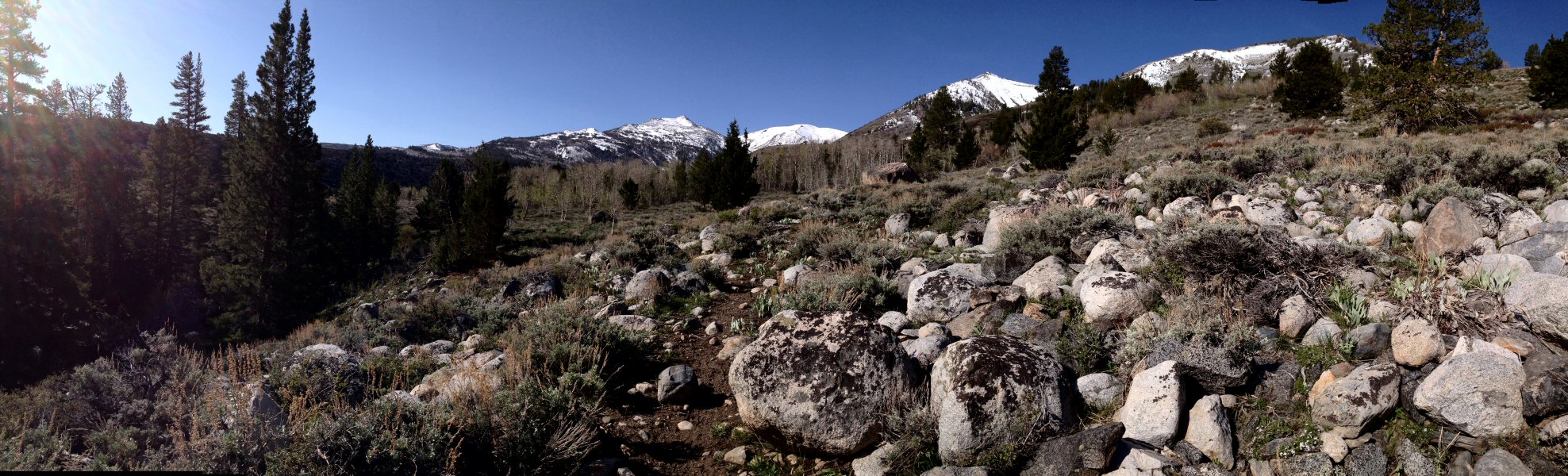
By midmorning the next day we turned off Hwy 2 and headed down a Forest Service Road toward Money Creek. Like many of the waters we’d fish that week, Money Creek is small pocket. The type of creek that attracts very few people, most likely fly fishermen with self-esteem issues. But its small dry fly water is worth a few casts. We were a bit too heavily armed, perhaps optimistically, with 3 wt. rods. We agreed to meet at the next bend to decide on whether we would extend our stay.
The weather was warm enough to allow wet wading but the water cool enough for the fish. Dense forest shaded both banks, their branches demanded care when casting unless we stepped into the water to make an upstream cast, which is my favorite tactic on previously unvisited water. The first step into the water was mildly shocking.
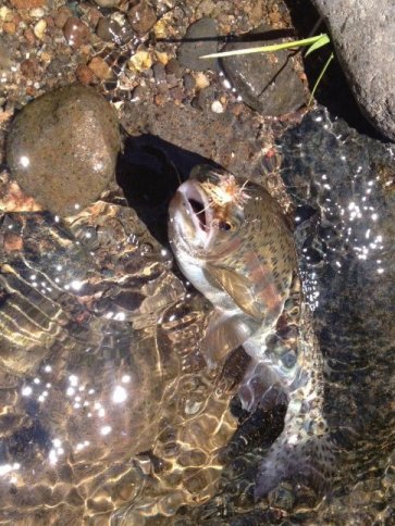
It’d been too long since I last laid hand to a fly rod, but the old muscle memory came back fast enough to generally place flies where trout might be looking. Without a visible hatch and expecting these to be wild and relatively unmolested fish, both Mark and I had tied on stimulator flies of one kind or another: Mark’s with an orange body, mine in yellow. The color didn’t matter; both were about size 16.
Quick strikes confirmed my guess; the trout were there. However, a lack of hookups suggested my fly was too big.
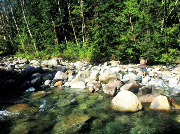
Mark working his way up Money Creek.
The benefit of not being a “purist” allows me to easily adopt strategies that other fly fishermen might frown upon. Rather than replace my size 16 fly, I tied a piece of tippet, about 10 inches, on to the stimulator, onto which I tied a size 20 Elk Hair Caddis. The biggest benefit to this setup is that the larger stimulator would give me an approximate location of my smaller, almost invisible fly.
That’s all it took. Later, Mark reported numerous strikes but not one fish to hand. I had landed half a dozen or so. The largest was about eight inches. It was a promising start. During the day we’d fish other creeks. We’d pass up others, usually because the footing was too treacherous for two not-in-their-prime guys. We found willing fish in the East Fork Miller Creek, before it merges with the Tye River to create the South Fork of the Skykomish River. Other waters on our list included Foss River, Rinker Creek and Quartz Creek.
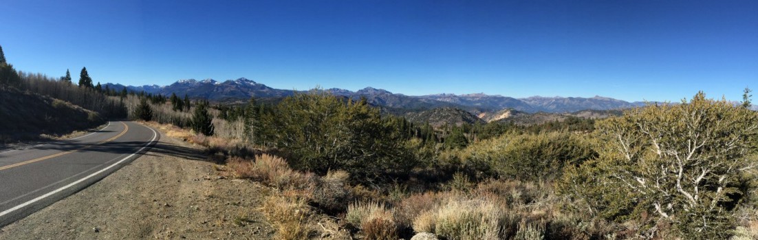
Just after noon we had run out of easily accessible water and headed over Stevens Pass to make the descent into eastern Washington. We were talking like brothers can and munching on snacks, and the scenery whizzed by. That should have been a clue. The state trooper in the oncoming lane turned on his lights and made a U-turn. I couldn’t see any other cars headed east.
In retrospect, I found it heartening that I didn’t feel my stomach dip or my heart flutter with the realization those red and blue lights were for me. A quick check of my paperwork, an admonishment to slow down, and we were off again.
Mark interrupted our descent toward Wenatchee, suggesting we pull over to check out Nason Creek, which slips in and out of sight of the highway for many miles. This was a spot he’d checked out before. It was a broad, flat bend in the creek, its slow water hemmed in by broadleaf trees.
I half looked for signs of fish. This is the best way to spot a fish. This looking/not-looking – unfocusing on what you want to see – reveals subtle movements at the edges of your vision. Shadows, formerly rocks, start to sway back forth. Just above, the streamlined body. First one, then two, and a third and fourth. I pointed them out to Mark.
Then my jaw went slack and I went silent. An impossibly large trout swims into view. Larger dots along its back suggest it’s a brown trout. It would be former brood stock beyond its prime breeding years, but I’d rather believe it’s a wild and clearly piscivorous fish.
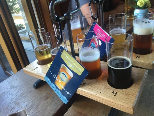
A welcome flight at Icicle Brewing.
Before heading into Leavenworth for lunch, we sought out access on Icicle Creek, but hunger, fatigue and unfamiliarity with the area made beer and lunch more attractive. We stopped and walked a couple of blocks to Icicle Brewing Company.
The heat of eastern Washington was unlike anything I’ve felt before. It’s terribly dry. Even a small breeze feels like sandpaper. Shade offers only minor relief.
We lingered while munching on a pretzel, landjaeger and a meat and cheese platter, critiquing the beer and musing about unimportant things. (Who matched pretzels to mustard in the first place?) From Leavenworth it should have taken about 75 minutes to the house in Chelan but construction delays added about 40 minutes. Enough time for Mark to get in a nap.
Chelan was still baking in the afternoon sun when we arrived. We’d bake the rest of the week.