There was exploration, fish caught, and the folks who raised us would revisit an old vacation spot at 9,000 feet — all despite weather last week that threatened to put the kibosh on all of it.
I started a mini-vacation two Fridays ago with a run up to the cabin, for once not battling traffic for any of the 142 miles. The plan was to get in a bit of fishing before the parents arrived Sunday afternoon and a drive over Tioga and Sonora passes on Monday. Besides an introduction to the cabin, history was the main reason for this tour. Our family typically spent vacation in one of the best possible venues, outdoors and many summers that meant Tuolumne Meadows.
But as of Friday, both passes were closed as late-season snow fell under dark gray clouds.
Willing to gamble only so much on the weather that afternoon, I set out for the ol’ irrigation canal, knowing it offers shelter and, if needed, a quick exit. During a few short hours the shifting weather offered sunshine, rain, hail and even a light flurry of snow. The fishing was as expected; my flies were hit mostly by wild browns and only the smartest stocked rainbows that hadn’t fall victim to salmon eggs or spinners. The stink of a possible skunking lifted, I retreated to a hot dinner and prepared for the next two days.
Instead of huddling inside, I was up before the sun on Saturday counting on the early hour and cold weather — about 48°F — working to my advantage. I choose wisely. Although I was on a well-fished creek, it was just me, the trout and couple of ducks for three hours. Fortitude and toughness won me solitude and a good number of fish that morning. Or, perhaps, it just proves that early bird adage.
By midday I was cleaned up and headed to the Moccasin Creek Hatchery for Trout Fest; the only time of the year that anyone is allowed to put a hook in its raceways. The grins of the kids were contagious; the K-9 demo of a quagga mussel search pretty amazing, and the general mood was generally festive. A local fly fishing club offered casting instruction in another raceway, allowing folks to cast an all-to-big fly to trout with appetites bigger than their four or five inches. I talked up a few of the hatchery personnel in hopes of lining up my plans for Sunday morning.
Those conversations suggested a return to the lower North Fork of the Tuolumne (near Basin Creek), a section of the river I had first visited about four years ago and enjoyed as an early season venue. This section is deep in a canyon and quite beautiful, despite its relative closeness to civilization. Most of the fish I caught back then there were stocked and in the intervening years that section of the Tuolumne had fallen off the stocking list as the result of an environmental lawsuit. But the word was that there were wild trout to be found.
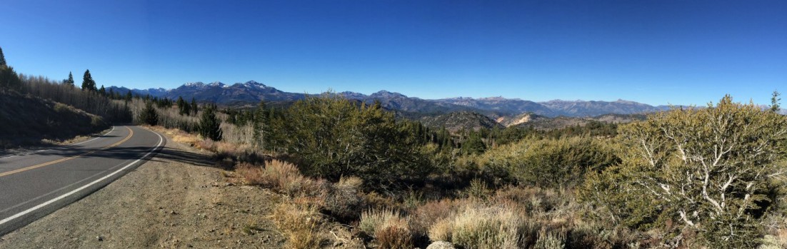
Usually I’m up and out the door at the crack of dawn, but I’d reserved that Sunday morning for leisurely exploration of Forest Service roads outside of Long Barn. I was surprised to find much of my route paved with asphalt, and after marking a good-looking creek or two on the GPS, I headed to Tuolumne City and the four-mile descent to the lower North Fork of the Tuolumne.
Like so often happens, a small, nice looking wild rainbow slammed my dry fly on the first cast. (They always seem to do that when I’m least prepared.) I missed that first fish but managed to find almost dozen other little rainbows, scattered in the likely spots.
After a morning of rewards, I headed back to a hot shower before the arrival of the parents. But the folks’ visit will have to wait until next week.
If you have any inclination to fish the high country in the central Sierra Nevada, now’s that time to get going.
The two pictures below of the a side channel of the Tuolumne River were taken from roughly the same position in the Tuolumne Meadows campground, looking toward Lembert Dome. The left-hand photo was taken last week (May 28, 2012). The right-hand photo was taken during late June 2011.
In all fairness, my dad didn’t see it coming. I blame it on the thin air or the simple joy of being outdoors in God’s country.
For more than a few years, my brother, my sister, and I eagerly anticipated a week or more of camping in the Tuolumne Meadows campground. These trips were filled with hiking, fishing, campfires, hiking that was sporadically interrupted by fishing, and that general freedom engendered by nature’s wide-open spaces.
Many hikes started in the campground or nearby, which meant a starting elevation of at least 8,500 feet and often closer to 9,500 feet. Many of the trails were obvious or followed rivers or streams, and were usually marked on the USGS maps dad packed with the space blankets, water, lunches, snacks and other supplies. Some hikes were long and generally flat, others shorter but a bit tougher on the shorter legs of kids. The trail to Lake Elizabeth gained about 1,000 feet in elevation over 4.5 miles. Getting to Gaylor Lakes required rising 600 feet in what seemed like the first mile of the three. (Gaylor Lakes supposedly offered great fishing, but the inhalation of swarms of mosquitoes that rose with every step on the surrounding marshes cut the trip short.)
Lembert Dome — a 900-foot tall mass of granite — towers above the nearby Tuolumne River. From the meadows one can often see tiny people standing on top. Then, one summer, me, my dad, my brother and my sister saddled up and began an ill-fated hike that would take us to the top of the dome on a relatively easy trail, but one that grows steeper as it ascends the backside.
The trail cut through a forest and over a few streams as it traced the lower edge of the dome, then looped toward the back the dome. All the while we gained elevation, but it’s the last fourth of the 2.8 miles that asked the most of our legs. This climb started with a clear demarcation of the alpine zone. Trees became fewer and shorter, some stunted, and soon we stood on granite. Then it got a bit tricky, with some rock scrambling and careful footwork required before we reached the top.
Yes, we made it... (This is the original, unaltered photo. Scroll down for a better colorized version. And where the heck did I get that belt buckle?)
Standing on top of this massive granite dome, where the air seems just slightly thinner, the deep greens of the meadows and trees contrast with a sky of eye-straining blues and snow-capped mountains reaching 11,000 feet or more. We lingered and marveled; maybe a bit too long.
Not exactly the best boots for hiking.
The hike had taken a little bit longer than expected and dad was a tad anxious about getting back to camp dome before dark. From where we stood, the face of the dome didn’t look too steep. It also looked like a shortcut.
We didn’t know that there was a surprising amount of glacial polish and exfoliation, cracks parallel to the surface that develop with expansion and contraction‡. Our Sears Roebuck and Co. boots would have been more at home on a flat construction site and offered limited grip. (You might know these boots; versions are still sold today under the Diehard brand — the ones with white leather crepe sole with a tread best described as small rolling hills.) Baseball-sized rocks and small BBs of decomposed granite tumbled beside us as we picked our way down.
We’d also find out that the stitching and rivets in our jeans didn’t offer much traction. It wasn’t easy to walk down the steep granite, so we controlled much of our descent with the seat of our pants. Literally. We slid on our bums. I think our pants gave up their last threads that day.
We did make it down Lembert Dome that afternoon and my brother and I hiked back to camp with just a bit of bravado. Dad, no doubt, and probably my sister, were relieved.
We were too young to be appropriately terrified worried that day. Now that age has tempered my bravado, when I think about this, I’m suitably scared for that young man. But I’m always glad that he had this adventure.
...and here we are with the color slightly adjusted. (Forgot that Mark was ever so small.)
Us kids looking out from atop Lembert Dome. Not so scary...
My brother, my son, and I made it back in 2011. This time there'd be no sliding down Lembert Dome's face.
† This prompt was issued a few days ago, but nothing immediately think came to mind, which I chalk up to a lack of adventurousness the preparedness taught to me by the Boy Scouts.
‡ There is no general agreement among geologists as to the exact cause of this phenomenon.
About a month ago, Willy and I loaded up at his house and left just before 7:00 a.m. and headed east, skipping from one highway to another, toward Toms Place, Calif., the annual fall destination for the club’s Eastern Sierra outing. It’d be my fourth. Along the way we’d be travelling through the Sierra foothills and Yosemite*, stopping at the Crowley Lake Marina for a quagga mussel inspection of Willy’s Bay Ranger.
Over the last eight-plus years I’ve had multiple opportunities to drive Hwy 120, up along scrubland bordering Priest Grade to where the highway becomes Big Oak Flat Road and winds through the sparse foothill woodland surrounding Groveland and much of the roadway, then finally rising into heavier stands of conifers — more correctly a lower montane forest — before the Yosemite entrance station at about 5,000 feet. My past trips encompassed ambitious one-day, 225-mile fishing trips with stops to cast a line at four or five different creeks or rivers as well as motorcycling over Sonora and Tioga passes shortly after opening, when snowdrifts 10-plus feet high line the high-country portions of the road.
It’s a fantastic road trip, to be sure, but on this drive I found that the view was very different from the passenger’s seat of Willy’s Cadillac Escalade.
The motley crew that would comprise the 2011 DVFF Eastern Sierra Trip.
The road welcomed us with limited traffic, and only a few miles of road construction slowed our progress. Anyone who’s driven through Tracy, Manteca and Oakdale — perhaps headed to Two Mile Bar or Goodwin Dam on the Stanislaus River — know that there’s plenty of nothing to look at. It’s here that the road seems to drone on between orchards and field crops, time seems to slow and I’m thankful that the highway is now three lanes through Tracy, once a bottleneck no matter the time of day.
It’s outside of the appropriately named Oakdale that the oak woodland takes hold. The oak trees and an occasional gray pine break up the monotony of the now golden grasses. Then there’s the always subtle shock of the “girls, girls, girls” sign that appears out of nowhere, perched above a rundown hotel and shadowy outbuilding truly in the middle of nowhere, all of which is enclosed by a substantial not-so-ornamental iron fence. That sign is also a landmark signaling the last mile or so before the right turn toward Yosemite.
The history of the Sierra foothills comes to life driving through Big Oak Flat and Groveland in the form of vacant stone buildings adorned with iron shutters and doors that recognize the danger of fire during the hot summers. Jeffery, Yellow and Ponderosa fight for space between buildings. The road here barely allows the passing of two motorhomes, forcing life to slow to a crawl. Not necessarily a bad thing.
As we approached the national park border the density of the forest was more imposing than my long held impression resulting from occasional glances from the driver’s seat. I’d seen these trees before, but details now stood out. A thick green canopy blocks any view of the sky and despite a distinct lack of branches from the ground to a few feet above the average man’s head, there were so many trees that the concentration of trunks cut the range of visibility to a couple hundred yards. As the miles slide by, the undergrowth grows lush.
More than just a stop to hit the restrooms, the Big Oak Flat entrance to Yosemite marks the start of a big change in vegetation and terrain. After another half hour and a left turn toward Tuolumne Meadows, Western Juniper, Red Fir and Lodgepole Pine dominate the view, indicators of the upper montane forest. Meadows of unreal green — in essence nature’s sponges for snowmelt — occasionally come in to view, edged by skunk cabbage and corn lily. In another hour, slabs of granite and collections of boulders begin to replace meadows.
Then, unexpectedly, the view opens up to vast expanses of what I’ve always known as granite and that, in all of my limited travels, seems to be the unique calling card of the Yosemite high country. A less brilliant white, I’d later learn that it’s actually a mix of granitoids and in many cases leans toward granodiorite, which is darker, almost moody and reflective of the changeable weather. It also marks the march into the subalpine forest as one nears 9,000 feet in elevation.
This day was clear and the only distraction was a fuel gauge needle too close to “E” for comfort. Since I tend to measure distance by time instead of mileage, I guessed that the gas station in Tuolumne Meadows would arrive at least a few comfortable miles before the needle was pegged. I grimaced a bit with each incline and hoped I was right.
The East side of the Sierra Nevada mountains. (Photo courtesy Fed Glaser.)
My concerns were alleviated by the sight of the sapphire-blue waters of Tenaya Lake, probably one of the most photographed bodies of water within the borders of Yosemite National Park. The beauty of Tenaya belies the fact that it’s a barren, fishless lake. Thankfully, I knew it was less than 10 miles to the Tuolumne Meadows gas station, one of the few Chevron stations with a mini-store that offers rock climbing equipment for sale and rent. We’d done alright so far. It was 11:00 a.m., putting us on schedule to stop for lunch in Lee Vining.
This time the appearance of Tuolumne Meadows and its namesake river was a far cry from a visit in June with my brother and one son. The river was no longer near flood stage; the water had receded and the meadow was again grass. Lembert Dome loomed above us, sheer peaks watched from the southeast and the now fishable Dana Fork of the Tuolumne River teased us from alongside the road. Soon we reached Tioga Pass station and began a descent that would take us past Tioga and Ellery lakes, and into Lee Vining Canyon.
This 9-mile stretch of road harbors the majority of my childhood memories of family vacations. Scattered about are small meadows dotted with small stands of Lodgepole and other pines, and laced by small streams with small, willing wild brook and brown trout. Tioga Lake recalls a day of crazy fishing, when my sister, brother, dad and I stood on rocks a few feet above the lake casting spinners and watching the (stocked) rainbow trout chase our lures, only to strike at the last minute.
It all changes after Ellery Lake. Sheer rock is the predominate feature. Only small plants and hardy trees cling to crevices. Only on the canyon floor, the eventual destination of Lee Vining Creek after its exit from Ellery Lake, offers any great expanse of green. The Eastern Sierra high desert — a Pinyon pine-Juniper woodland — begins near the canyon floor, offering a stark contrast, beautiful in its own way, to the forest passed through to get there.
We had about 12 more miles to Lee Vining and sat down for lunch on the patio at Bodie Mike’s Barbeque just after noon. With the seasoning that comes with eating out-of-doors, we dug in, enjoying the view toward Mono Lake between bites. It was a quick drive to Crowley Lake Marina to surprise the marina attendant with a bone-dry boat. It took longer to affix the tag than conduct the inspection.
A few minutes later we tucked our stuff into the cabin to find ourselves with more time than expected on our hands. The afternoon sun was still well above the mountains to the west. We were there to fish, so took a short stroll to the nearby Rock Creek to cast a few flies.
Rock Creek isn’t too big, but usually heavily stocked and fished just as much. Willy and I split up. I would find a few rising fish willing to strike my offerings, but the kicker was Willy’s first fish — his first post retirement trout. A not-too-shabby brown trout of about 14 inches.
We spent a bit more time casting to rising fish, next to the opposite shore, of course. A few took our offerings, fewer were landed, but it was good to spend a few hours getting the “skunk” off before dinner.
Looking back, it was a good start to what would be a trip that was great for reasons I didn’t expect.
*Not through Yosemite Valley, however. The road to the valley dead ends near the Happy Isles Visitor Center. Hwy 120 passes the valley and heads through the high country and Tuolumne Meadows, then over Tioga Pass.
By the time you read this it’ll be official. I’ll have ridden 10,000 miles on two wheels.
There are those who’ll say I was getting in front of a possible midlife crisis with the purchase of my first motorcycle just about four and a half years ago. I’d disagree. The idea of riding has bounced around my brain since riding a friend’s off-road bike, so long ago as a kid.
Like fly fishing, riding was one of those things that looked fun, but something I never truly could envision myself doing. And like fly fishing, choosing to ride any particular day influences planning, gear and even the pace.
To be clear, in both cases I favor a slower pace.
This pace was reflected in the process that led me to motorcycling, starting with a Motorcycle Safety Foundation class, just to see if I might possess the skills to ride and to determine — taking into account the possibility of dropping someone else’s motorcycle — whether it still offered the enjoyment I remembered from years ago.
I’d be remiss to not give credit to my wife, who works in the healthcare field and often used the term “donor-cycle,” for supporting my desire to at least try motorcycling. Even knowing that my dad had a decidedly unpleasant motorcycling accident that led to his not riding, I went ahead with registration for the class — with my oldest son joining me — with no particular plan to purchase a motorcycle. That’s not to say I didn’t have thoughts about something in the Honda CB series… Sean and I both passed the class with flying colors and by early December 2007 our driver’s licenses carried an M1 endorsement.
[singlepic id=297 w=368 h=275 float=center]
The first bike.
Though I had no immediate plan buy a motorcycle, the universe had something else in mind. Only four weeks after getting my M1 endorsement I became the owner of a venerable 1982 Honda CB650SC with about 8,000 miles on it. Now owned by my son, this vintage Nighthawk gently taught me the basics. It was a great starter bike; easy and fun to ride. It also taught me that two-wheeled transportation, while giving one a true appreciation for highway speeds, can make one feel more connected to the world. Maybe it’s the safety-conscious swiveling of my head, but I seem to see more when riding.
I definitely feel more when riding. My commute is about 30 miles one way on a state highway that passes through reclaimed marshland of the San Pablo Bay National Wildlife Refuge, farmland and by a cattle ranch, all the time skirting the upper edge of San Francisco Bay. (Technically it’s San Pablo Bay.) Despite protective riding gear, the microclimates are readily apparent. When the weather’s warmer, the water of the marshes retain enough heat to create a “banana belt” that makes my early morning ride more comfortable. But once I drop over a small ridge, heading closer to the coast, the air temperature invariably drops 5 to 10 degrees.
Two bikes, two fly rods, two reels and an extra gallon of gas.
It was sad to see that first bike go, but nice to know it’d still be in the family. Even more exciting was the fact that on July 24, 2009, I took possession of a motorcycle that through its production years (1992-2003) had been my favorite: the Honda CB750F/Nighthawk 750. Mine’s from ’97 and had less than 4,000 miles on it when purchased. It’s now fitted with a windscreen, luggage and risers. I like it and its average of nearly 50 mpg.
So here I am, 10,000 miles later. Yes, there have been two close calls, both due to inattentive drivers. (And yes, my wife knows about them.) I’m thankful that whomever is watching over me is doing so and I’ve learned to ride within my limits. I’ve come to grudgingly accept that the buffer I put between myself and the car in front of me is often instead seen by “cagers” (car drivers) as an opportunity.
Those who know me know I take care of my vehicles. But the motorcycle is unlike the cars. Once and a while I find myself simply staring at the motorcycle, an old-school symbol of freedom, still not fully believing I own and regularly ride one.
I’ve no way of checking, but I’m pretty sure hell’s frozen over.
After eight years since his last appearance in the Golden State, my brother showed up with no specific plans. That’s where I stepped in as travel agent, outfitter and guide; apparently a role that suits me better than might be expected.
Lembert Dome viewed from the Tuolumne Meadows Campground, and where we'd be going.
A visit to the cabin is akin to establishing a base camp. In our case, a base camp stocked with beef jerky, beer and an XBox. One might be inclined to think it was something like a “man cave,” but there’s an irony to my brother and I spending quality man time together. Those who’ve been in the proximity when we get together know that we quickly prove the adage that you can’t take the boy out of the man.
Mark lives in the Evergraygreen state and while he said he’d enjoy seeing California family members, it became clear that he perhaps more happy to see the sun. I swung by the airport to him pick up Wednesday evening and we met up with my oldest son, Sean, at the Bass Pro Shop in Manteca. We secured a two-day nonresident fishing license, grabbed dinner and headed up the hill.
Weather-wise, we’d hit it right. Temperatures had peaked that day and would be still warm but slightly lower the next few days, meaning it would cool off at night; something important for a good night’s sleep in a cabin that has no insulation and no air conditioning.
Before Mark or Sean posts a comment below, I will admit that I was adamant that I would I had expected to wake up and hit the road for Tuolumne Meadows early the next morning. I did wake up at 5:00 a.m. But I rolled over and caught a few more winks.
Mark had asked if we might be able to hike up Lembert Dome. He and I had done so back when we were boys, with my sister and dad. It’s a pretty easy drive from the cabin to Tuolumne Meadows, just about 2½ hours. Since Tioga Pass had opened the week before, we would circle our way back over Sonora Pass.
Mark's friend, the Marmot, at Olmstead Point.
It’s been said many times before, but the blue of the sky is remarkable at higher altitudes, and we weren’t disappointed. With only a few clouds in the sky, we passed through the entrance station and soon arrived at Olmstead Point. Reinforcing that he boy stills lives within the man, Mark was all about seeing and getting photos of the marmots of our childhood at Olmstead. A few marmots obliged.
We next stopped at the Tuolumne Meadows Campground, where we spent many a family vacation camping. Sure, some things have changed — mostly manmade things — but nearly everything was recognizable and Mark and I soon agreed upon the location of “our” campsite, partially based on its position relative to the Tuolumne River, which itself was nearly unrecognizably high. I’m sure Sean was somewhat amused by our reminiscing.
Just down the road we pulled into the parking lot at the Lembert Dome trailhead and loaded up. The trail begins with a modest incline, but starting at about 8,600 feet and rising another 800 feet to the dome’s summit, it was soon clear that our lungs would get the kind of workout not seen in years. The gradient seemed to increase every 100 feet, and even if we were on the trail (we weren’t), it would be covered by extensive snow fields that made the hiking more difficult. At one point, Mark fell through the snow into a waist-high air pocket. Undaunted but pausing more often that we’d care to admit to catch our breath, we pressed on. I’m sure it took a lot of patience for Sean to not charge ahead. (I don’t think he broke a sweat or even breathed hard.)
It’s said that the memory grows hazy over time and Mark and I didn’t remember the last stretch up the back of Lembert Dome being so steep or requiring so much climbing. But climb we did, reaching the top. The view was made a tad more incredible by the fact that we had it to ourselves.
Me, Mark & Sean a the top of Lembert Dome. (After Mark and I rested for half an hour just a few minutes.)
It was hoped that we’d also find some water to fish. Without much browbeating Mark had asked if he might get a chance to try fly fishing, and I had plenty of gear he could use. We rigged up and flogged the no-so-high-but-higher-than-usual Lee Vining Creek. It was tough going. I was the only one to get two strikes, but missed both fish.
We refueled our egos with some good barbecue at Bodie Mike’s, then headed north to Bridgeport, and I pointed out all of the water that we might have fished. Every single river was the color Yoo-Hoo.
Traveling creates memories, and traversing the Sierra Nevada Mountains can make for some of the most vivid memories. Then there are other things that one doesn’t soon forget.
Our return to the cabin meant a few preparations for the next day, when we’d get out on “Hatchery Creek,” hoping to get Mark into his first trout on a fly rod. Mark looked to verify that his fish license was in his wallet. It was. His driver’s license wasn’t. He searched through my car. Sean looked through his car. I looked around the cabin. Mark began to go through his suitcase. After thinking about it a bit, I called Bass Pro Shop. The customer service rep went through the lost and found, looking for a Washington license with the appropriate name and a goofy looking photo.
Soon we were making the 1½-hour drive back to Manteca. Only a few miles went by without Sean or I reminding Mark of his snafu.
There was an upside to this. We enjoyed a manly dinner at the House of Beef.
Back at the cabin, assurances were made that I’d not linger in bed the next morning as there’d be fish to catch. And I did not.
But Mark’s First Fly Fishing Experience is a story unto itself, and for next week.
(You can find more photos here under “The Brother’s Visit – Tuolumne Meadows, Eastern Sierra, First Time Fly Fishing”.)
A marmot at Olmstead Point, a stop on our way to Tuolumne Meadows, and a hike that would require the full use of our lungs.
Looking at our Target - Lembert Dome - from Tuolumne Meadows Campground, over the very swollen Tuolumne River. The hike is 1.5 miles with an 800-foot elevation gain.
Mark and Sean on the last stretch up the back of Lembert Dome.
The view from Lembert Dome, looking out over Tuolumne Meadows.
Mark's first experience fly fishing...obviously it went well.
 Willing to gamble only so much on the weather that afternoon, I set out for the ol’ irrigation canal, knowing it offers shelter and, if needed, a quick exit. During a few short hours the shifting weather offered sunshine, rain, hail and even a light flurry of snow. The fishing was as expected; my flies were hit mostly by wild browns and only the smartest stocked rainbows that hadn’t fall victim to salmon eggs or spinners. The stink of a possible skunking lifted, I retreated to a hot dinner and prepared for the next two days.


