It’s become accepted in an era of InstaFaceGooTumblr that without visual evidence you’re not to be believed.
…which explains the fact that a search of “fly fishing photography” yields over 20 million results. It appears customary for articles about “catch and release” in mainstream fly fishing media and other outlets to include how to take a grip and grin with minimal impact on the fish. Even a few detail how the solitary fisherman can take better photos.
My experience fishing alone has taught me that there is no easy way to take a decent photo. When I did, it was only to prove my fly fishing prowess luck.
Not anymore.
It could be argued that trout are the most beautiful freshwater game fish. Yes, their coloration goes beyond simple camouflage, it is sprinkled with a subtle and unmatched beauty for which words are inadequate.
I’d like to say it’s that beauty that leads fly fisherman so often post or carry photos of fish. But more often than not, these poses — “hero shots” — show a fish in a most unnatural environment: out of water, often in midair, and in a human’s hands.
Getting a good photo when fishing solo is something I haven’t mastered. There’s the bumbling for the camera once the fish is in the net. The instant the camera’s turned on the trout, at least the ones I land, decide to be as uncooperative as possible. Most of my first shots are unattractive photos of their backs. There might be a second attempt but by the third try, sympathy for the fish wins, and I let it slide out from the net.
That’s not to say I won’t take any fish photos whatsoever when fishing solo, but there’ll be no more arm’s length shots; maybe photos only of that remarkable fish, landed quickly and handled minimally, in the net in the water. With any luck, I’ll learn how to take underwater shots.
Next time I tell you I landed a few trout, you’ll just have to trust me.
I, for one, believe the best adventures of childhood were often found in the backyard or within one’s immediate neighborhood. As adults we learn of the wider world, of places that are ancient and historical, mysterious, full of wild lands and animals. It’s true, but a life lived yearning to visit these places can let the wonder right outside our door slip away unnoticed.
It was expected that this week at the cabin would entail local exploration, the type of exploration allowed only by ignoring the clock and following a path chosen in the few moments before our next step.
So it was that Karen and I found ourselves at Calaveras Big Trees State Park, after, of course, stopping along the way to pick up seasonal favorites: apple cider donuts and fresh-pressed cider. I was familiar with the area, which is about an hour away from the cabin, but only as an extension of my search for new fishing waters, namely Beaver Creek and the North Fork of the Stanislaus River. To explain briefly, Calaveras Big Trees was created to preserver two groves of some of the most massive giant sequoia trees. (Not always the tallest, but volumetrically the world’s largest trees.) These are Sequoiadendron giganteum, the inland relative to the perhaps more familiar coast redwood (Sequoia sempervirens.
The morning was spend wandering among these enormous trees, looking upward until our neck muscles complained during a hike that covered a few miles. But if the sequoias were the big stars of the show, big leaf maples and dogwoods were the flashy supporting players; this time of year decked out in shades of red, yellow and orange. Their dazzling colors proving that “Autumn is a second spring when every leaf is a flower.”1
Pictures are worth more words than I could possible write, so below is a gallery, a glimpse of what we saw.
1 Albert Camus
Looking through the forest.
Yellow Emerging
Dead Tree Amid Yellow
Looking Up
Red on a Background of Yellow
North Grove Trail
Us
“Old Bachelor”
Big Trees & Fall Color
Pacific Yew in one the few places it grows alongside sequoias.
We snuck out of the Bay Area on the Thursday a week ago for long weekend, planning to cram a bit of everything into the time we had.
Railroad ties at the West Side Rail Grade trail head.
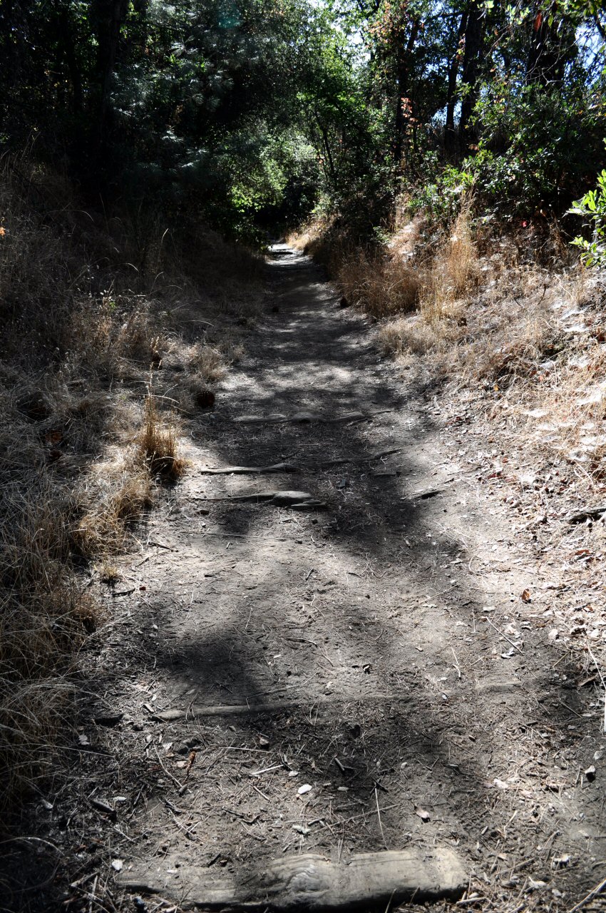
In a new spirit of exploring unknown parts of familiar territory, we ended up on the West Side Rail Grade the next morning. The trail — really a former narrow-gauge railbed — begins on Buchanan Road in Tuolumne City and is carved into the hillside above the North Fork Tuolumne River, on the north side of the canyon. It was christened in 1898 as the Hetch Hetchy & Yosemite Valley Railroad under the ownership of the West Side Lumber Co., which used narrow-gauge railroads in the Sierra Nevada Mountains until the 1960s. The HH&YV was primarily employed to haul fresh-cut logs from the sugar pine forests of eastern Tuolumne County to the West Side Lumber Mill in Tuolumne City.
The trailhead is just outside of town, and the first 100 yards are marked by decomposing railroad ties that look like worn steps. After that, most of the trail is exposed, which left us to bake in a remarkably hot morning sun. There are a couple places where benches and tables allow for a break in the shade, and a sprinkling of poison oak along the trail encourages one to stick to the well-worn path.
Though I’m not a history buff, per se, it’s a pleasant surprise to find remains of history in situ. About a mile down the trail we came across long portions of ties and rails, with the trail occasionally shifting from one side of the tracks to the other.
Rails of the Hetch Hetchy & Yosemite Valley Railroad.
The grade slopes gently downward, at least for as far as we hiked, and it would be a great place to break in some new boots. Had we continued the full 4½-plus miles, we could have soaked our toes in the North Fork of the Tuolumne River, near Basin Creek. (I originally discovered part of the West Side Rail trail while exploring Forest Service land above Long Barn, and while fishing an upstream portion of the Tuolumne, but have since determined that was another section of the trail that stretches from Hull Creek to the Clavey River, that that’s another hike for another time.)
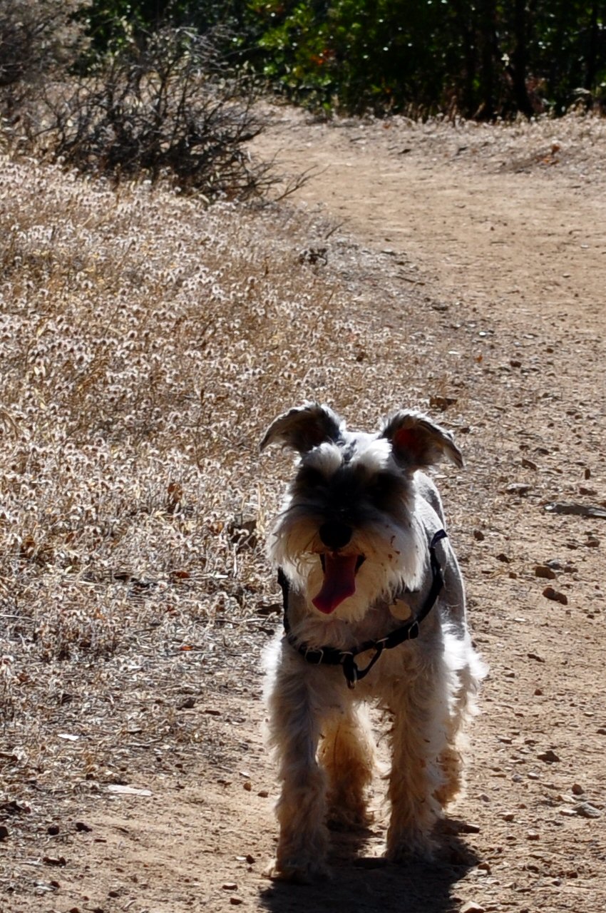
Hot and happy dog.
We met a few folks along the way: an overachiever who was jogging uphill and a few women who walk it almost every day, one of whom had made a dramatic move from the northern California coastal town of Bolinas to the much drier Sierra foothills.
With the full heat of the sun soon approaching, we left the exploration of a last blind curve for another time, and headed back. This day we had the dog with us and I don’t know if it was he or I who was panting more in the heat.
I have a feeling, though, that we’ll see more of this trail in the spring.
Railroad ties at the West Side Rail Grade trailhead.
Nevada waiting. I think he was always 10 yards ahead of us.
Looking downstream (west) from the West Side Rail Grade.
Rails of the Hetch Hetchy & Yosemite Valley Railroad.
Erosion threatening to dismantle part of the HH&YVRR.
The last bend before he turned around. “I’ll be back.”
Sometimes life just throws a curveball. Two weeks ago it felt like every curveball was followed by another.
So, I abandoned the original plans to sandwich a cabin visit with the sister and family between two full days of fishing and just go with the flow.
That meant the two-and-a-half hour drive to Twain Harte stretched out to about four, interrupted by a longer than usual stop at Bass Pro.
It also took longer than usual to coax that first trout to take a fly in a nearby stream.
Back at the cabin, I whiled away some time reading and generally taking it easy.
The sister, her husband and two sons taller than most everyone pulled in about noon Friday. Soon enough we were beating the heat at Twain Harte Lake. A visit to the cabin is a mixed blessing during hot weather; the lake offers respite, complete with an old-school snack shack with burgers, fries, milkshakes and snow cones. The cabin, however, and despite a lack of insulation, seems to retain all the heat of the day well into the evening.
The nephews goaded their parents into the usual swim to a platform near the center of the lake, then a swim to “The Rock.” Then back. I admired their energy from shore, dipping my feet in the water and reading. The afternoon was completed with a visit to the snack shack.
Normally the only overexertion on my vacations entails scrambling over boulders and under downed trees in search of trouts that sometimes aren’t there. Saturday I opted for an easy, sure thing, fishing a well-stocked creek that’s often pounded by the put-and-take crowd. This day I’d be alone for well into four hours, targeting specific fish and trying to coax dry-fly takes.
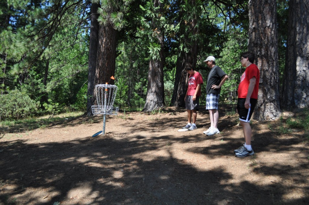
I found my cabin mates finishing up the breakfast clean up when I returned about mid-morning. They planned to hit the local disc golf course, and I figured I’d lug my camera along. I’ve come to realize that I don’t have a lot of hero shots of myself during fishing, hiking, motorcycling, etc., so I’m trying to step in to take a few photos for folks when I can.
The boys pondering Luci’s shot. Missed by that much.
This disc golf course is purely a volunteer effort that gets some financial support from the local community, and it’s nice to see younger folks join in the creation of something positive. The course winds its way through a now fallow traditional golf course, over an irrigation ditch and under a flume.
My nephew Nicholas plays Ultimate Frisbee and might be expected to be the odds-on favorite, and while Tom, his father, will deny his intense completive streak, it quickly became clear that the rest of us were there to, pretty much, watch a one-on-one match. On the fourth basket (hole) another player gave us another disc, allowing me to participate. Like the amateur I am, there was a lot of wasted effort spent on power when form was more important. I later learned that my arm isn’t as young as it used to be. There was no use keeping track of my score; I was always one stroke behind Tom or Nick. And where either of them could curve a Frisbee around an obstacle, my choice was limited to going straight through if I could or give it a very wide berth. The competition would end with Tom winning by a stroke. I believe Tom also won our game of mini golf that evening.
The afternoon was again spent on the beach, with swimming, conversation, tossing of the Frisbee and a return to the snack shack.
Proving that there’s not competiveness in their family, Tom and Nick returned to the disc golf course the morning before our departure for a grudge friendly rematch. Nick recovered some dignity with a win.
This short trip was a welcome, unscripted getaway.
Nathin launching one from the first tee.
Nathan letting one loose behind Lyons Canal.
Tom scoring on the first hole, aka basket.
The boys pondering Luci’s shot. Missed by that much.
Luci showing that form honed after years of playing disc golf. That or ballet.
Tom working out of the ‘rough.”
Nick in the rough. (It looks worse than it really was.)
Just about two weeks ago I awoke to two unfamiliar sights that dusted off old memories. Bright sunshine, a cloudless sky and startlingly green lawns made possible by man’s influence on the course of water in this Southern California desert.
I hadn’t been in Riverside County for more years that I care to count, and this was the first time in a long while that I was visiting the lower half of the state without any plan or itinerary. There was a more mundane reason for this trip, but much of the time it offered a chance to really look around.
There’s always a risk that memories won’t match up with the reality of a place after the passing of decades years. Not this time. Sure, there probably where more people, more cars on the road, and more of those funky strip malls that seem endemic to Southern California, but it was the nature of the place — something that I tend to tune into more than man-made landmarks — that matched my memories.
My viewpoint was a bit muddled…I had spent my early high school years looking east to find Mt. San Jacinto; this trip it was west. But much of the terrain was familiar. The steep escarpments of the San Jacinto and Santa Rosa mountain ranges. The dramatic demarcation between the watered and arid land of the Coachella Valley. The canyons carved over decades by flash floods. Clusters of course native grasses and sparse bushes watched over by the occasional ironwood tree.
A beauty of its own.
High above were the “sky islands” of the mountains. The Palm Springs Aerial Tram took us from a dry canyon (2,643 ft.) to the near alpine conditions surrounding the mountain station at 8,516 ft., where the snow was in the foreground of a view of the vast and dry valley below. This engineering marvel — only the first tower is accessible by road, the others only on foot and by helicopter — passes through five climate zones during its 2.5 mile climb.
Looking out over Palm Springs and the Coachella Valley desert from 8,500 feet.
Our drive one day included a stop at one of the big date ranches in Indio, where I was reminded how much I enjoy that fruit. (Those with lower moisture content, thus not sticky, can be good snacks to carry during hunting and fishing…) We also passed the Salton Sea, an ecological oddity that no one seems to know what to do with.
It’s always a risk revisiting a place of the “good ol’ days.” I’d dare say that this trip, and memories it created, were almost as good as those days long gone.
A beauty of its own.
Traveling down Box Canyon Road.
Looking down Box Canyon Road.
At the Forever Marilyn statue in Palm Springs.
Looking up at the route of the Palm Springs Aerial Tram.
Karen and mom at the overlook of the Palm Springs Aerial Tram.
The top station of the Palm Springs Aerial Tram.
Look down on the route of the Palm Springs Aerial Tram.
Looking out over Palm Springs and the Coachella Valley desert from 8,500 feet.
The ridge line at top of Palm Springs Aerial Tram.
I worry about women in fly fishing and how it might affect me.
Not because women take instruction better and may easily out cast and out fish me. Not because every other fly fishing blog post seems to include an image of any number of women that attract attention away from the fish they might be holding. I’m not so worried that with the emergence of fly fishing gear for women, I might someday try on a pair of waders only to find them a bit snug in the wrong places. I’m also not worried about the women-only fly fishing outings. (I can always volunteer to be the camp cook, right?) And I’m not worried that women tend to generally be better fly fishers than men. There are already so many people, male and female, who are more accomplished fly fishers than I.
Maybe it’s a self-confidence issue. I don’t view myself as that rugged, burly guy. Thank God my wife loves me, but I tend to fall in the adorkable category, leaning slightly more toward dork. Suffice to say, I don’t really stand out in any way. I can easily disappear in a crowd.
I am worried, however, that in any photo, even if I’m holding a sparkling, iridescent 24-inch trout, I’ll be upstaged by any women fly fisher who happens along to help with the netting.
The evidence is below. Not fly fishing, to be sure, and even though the deckhand is behind a decent halibut and attired in unflattering foul-weather gear, most comments about this photo weren’t about the fish, but about much she was leaning in, her smile, etc.
It turns the tables a bit when it’s the kids introducing parents to new places and experiences and revisiting the familiar after three decades is icing on the cake, though there’s bound to be disagreement in our personal memories.
[singlepic id=1223 w=300 h=400 float=right]
Mom and Dad at the cabin, for their first visit.
But easy agreement was found in the beauty of the scenery and shared remembrances during a long drive up and over Tioga Pass, along the shores of Mono Lake, before a return over Sonora Pass.
The parents arrived at the cabin late that Sunday afternoon, and after running an errand that took entirely too long for Dad, dinner was enjoyed and we settled in for the evening. Thankfully, the storm that had dumped snow on the passes had dissipated the day before and the warmth of the sunshine had cleared the roads.
Mom, Dad and I leisurely left Twain Harte with a route in mind but absent any planned stops or timetable. The hillsides leaned more toward gold, but were freckled by islands of still-green grass.
I’ve driven this road many mornings, but saw things a bit differently today since I wasn’t preoccupied with wetting my fly line. Miles rolled by, lubricated by conversation. Soon it was time for a stop to stretch our legs. Though there aren’t many hatcheries that will, in my mind, match the magnificence of the historic Mt. Whitney Fish Hatchery visited in my youth, there was something familiar about walking around the Moccasin Creek Hatchery with the folks.
After the excitement of gaining 1,500 feet in elevation over the two miles of the “new” Old Priest Grade, it was all new territory for Mom and Dad as we wound through Big Oak Flat, Groveland, and past Buck Meadows. Highway 120 took us from 2,838 feet at Big Oak Flat to Yosemite National Park’s Big Oak Flat Entrance Station at 4,900 feet. Dad was impressed by the tidiness of the towns and the number of old buildings alongside the roadway, many of which are still in use.
If it wasn’t enough to have fantastic weather, traffic was light. By mid morning we arrived at the entrance station, where the purchase of an annual pass got us across the park border. Words in many foreign languages hung in the cool air, reminding me of the many nature blessings that aren’t more than a day’s drive from home that attract visitors from around the world.
I’ve always throught that the changes in vegetation and terrain grow more dramatic once inside the formal boundaries of Yosemite. Heavy forest yielded to granite, which only seems to yield to water in the form of glaciers, ice and liquid. We pushed on to Olmsted Point, taking obligatory photos, then on to Tenaya Lake. Availing ourselves of the facilities near the lake, I made a mental note that I need to spend more time exploring Tenaya Lake and its surroundings.
There’s a drama that comes with finally emerging from the forest to be presented with the dramatic vista of Tuolumne Meadows, then dropping into the meadow itself. This time I was taken aback by the dramatic change in its appearance compared with that of last spring, when my brother, son and I were on our way to a challenging life-affirming hike to the top of nearby Lembert Dome. Last year the meadows were covered with water. This year, the grass was already the gray-brown of late August.
I had to explain to Dad that the Tuolumne Meadows campground wasn’t open yet when he asked why I was parking alongside the highway. He’d never been here so early in the season. (The campground would open two weeks later, rather early.) Though last June there was snow on the ground and big puddles filled with mosquito larvae, there was nothing of the sort this last week of May. A stroll toward the entrance was accompanied by a bit of debate about the differences between today’s visit and our memories of camping trips more than two decades ago. Regardless of the differences of opinion and any discrepancy in our memories, there was more than enough that was still the same to foster a feeling of familiarity.
[singlepic id=1218 w=600 h=407 float=center]
Mom and Dad’s triumphant return after 30-some years.
My worries about the water were confirmed during this walk through the campground when I stopped near the same spot from which I took a photo of Lembert Dome in 2011. Last year, there was no discernable difference between the channels of the Tuolumne River and the river itself, and the water was within two feet of the bottom of the Tuolumne Meadows (Hwy. 120) Bridge. This year, the channel nearest the campground was no more than a foot deep, and the river was barely touching the bridge abutments.
[singlepic id=1221 w=300 h=225 float=right]
The three of us at Leavitt Falls Overlook.
The reminiscing was further fueled by the sheer rock walls along the descent from Tioga Pass to Lee Vining. The thought of dropping in at Bodie Mike’s for a barbecue lunch was derailed by Dad’s sudden proposition of stopping at the Tioga Gas Mart — that he didn’t recall seeing before — to grab lunch at the Whoa Nellie Deli. A word of warning: Be careful what you order. It’s all big at Whoa Nellie. The Cowboy Steak Sandwich is not so much as sandwich as it is a steak slapped on a roll.
The easy drive north on Hwy. 395 from Lee Vining was a welcome change after such a big lunch. By the time we arrived to the intersection of Hwys. 395 and 108, the urge to nap had passed. A good thing considering the hairpin curves that would take us from 6,765 feet to 9,623 feet at Sonora Pass. Before our main ascent, the Leavitt Falls overlook offered a last opportunity to stretch our legs before the long trip over the pass. The reduced volume of water coming over the falls was another reminder that it’s going to be a dry year in the Sierra Nevada. We posed for photos, then began the long climb.
[singlepic id=1220 w=600 h=450 float=center]
Getting a roadside education at Sonora Pass.
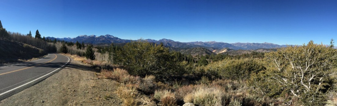
This was undiscovered country for the parents, who never had a reason to travel this road. To my eye, Hwy. 108 over Sonora Pass offers much more dramatic transitions. The road rises faster and the changes in terrain and vegetation follow suit. Surprised to find it open, we stopped at the Donnell Reservoir scenic overlook, with a sweeping over the Stanislaus River canyon and the Central Valley. The road from there is bit less remarkable, winding through heavy forest and passing towns that only seem to be wide spots in road.
It was a long but worthwhile day; one that both revived and created memories.
Juneau, I’ve been to Alaska… (Commence rolling of eyes.)
Perhaps familiarity dulls one’s perception of what’s seen every day. Perhaps this is why the colors of Alaska amaze me; and Juneau did not disappoint.
It’s fascinating that a state capital would, to this day, only be accessible by boat or plane. But that’s Juneau, a city that will fine a person who doesn’t secure trash cans properly — because of bears — before putting them at the curb. Though much more of a metro area than Ketchikan, Juneau, obviously, is still affected by the wild surrounding it.
Soon after the Sea Princess was secured dockside, we hopped on an excursion bus heading north out of town. The urbanity that is downtown Juneau faded into suburbs, which in turn dissolved into a thick rainforest. The forest soon gave way to a view of Mendenhall Lake and its source, the Mendenhall Glacier.
Mendenhall Glacier.
My first visit to Alaska a few years ago entailed flying into Anchorage, over waters tinged teal, almost turquoise, by glacial silt. Mendenhall Glacier displayed similarly dramatic coloration, though for a different reason. The blues associated with glaciers arises from the compression of ice over time, its melting and refreezing, which eliminates air bubbles and allows the ice to absorb the longer wavelengths of white light, resulting in shorter wavelengths (blue) being transmitted. Mendenhall was no exception.
The Tongass Mendenhall Glacier Visitor Center offered a great overview of the glacier and surrounding area, in both informational and visual aspects. The viewing of a short film and the visiting of various exhibits (and my wife’s visit with a fellow knitter) was followed by a walk near the iceberg-dotted Mendenhall Lake and along Steep Creek.
Beaver dam on Steep Creek.
Wildlife’s a big part of the Alaska experience, whether one purposely seeks out the wildlife or happens upon it. If my wife hadn’t pointed it out, I might have stepped on a small porcupine waddling on the visitor path. Small and unconcerned, it crossed the path and proceeded into the tall grass. Salmon, with the last slow movements of their life, edged upstream. Though unseen, beavers announced their presence with a network of dams.
Then there’s the bear, signaled by the “oohs” and “aahs” and crush of tourists to one side of the elevated walkway. Hidden beneath the leaves of streamside bushes, it waded upstream and swung from side to side, eyeing the water. Slowly, patiently, quietly it slipped upstream, unmindful of the cluster of people above. The sockeye was also oblivious…and soon was the bear’s lunch.
Bear stalking salmon in Steep Creek, near Mendenhall Glacier.
The next stop was one that began with concerns that it might be tourist trap: the Glacier Gardens Rainforest Adventure. (The “adventure” part is hyperbole.) Our group met near the base of a mountain among plantings of nonnative plants and unique “upside down trees.” While it’s a touching story of how this botanical garden was as much labor of love as it is a commercial nursery, it wasn’t quite what one would expect on a tour of an Alaskan rainforest.
In only a few minutes, however, we gained 300 feet in elevation and, with the commercial nursery far behind us, entered an untouched and lush rainforest. The drive was ably narrated by our knowledgeable and affable guide. Streams trickled under fern fronds. Rain dripped through the canopy. A walkway on the ridge offered a view over Juneau.
Alaskan Brewing’s Smoked Porter.
After lunch back on the ship, we spent time in Juneau as tourists, visiting various stores (focusing on those operated by local families), and stumbling upon the Alaskan Brewing Co. store. It was quickly learned that — and we took advantage of — a shuttle would soon depart for the brewery, where a tour and tasting were offered.
If you look up reviews of the Alaskan Brewing tour, they skew toward the positive. Don’t get me wrong, though the “tour” doesn’t entail walking around the actual brewery, the humorous tour guide did cover the entire history of Alaskan Brewing, brewing, and process by which the company develops new beers. I think, however, that the largely positive reviews may be slightly influenced by the generous size (see the photo to the right) and number of free samples.
I ended the day with a quick, late-evening walk into town to pick up an Alaskan Brewing glass for the oldest son. The sun set, the evening’s entertainment was enjoyed, and the ship set sail for Skagway, perhaps my favorite stop.
 Not anymore.