https://www.instagram.com/p/Bz0pY5rhhho/?utm_source=ig_web_copy_link
Category Archives: Walker Watershed
plenty of water and willing fish, and a return to Crooked Creek; part one
It’s a day off and I’m awake before sunrise. This time of morning on the West Slope of the Sierra Nevada, it won’t be light until the sun creeps above its soaring peaks. I like it this way. It’s a two-hour drive over Sonora Pass before dropping into the starkness of the Eastern Sierra. It’ll be a murky twilight until I crest the pass.
I shower and dress, gather my breakfast for the road, and quietly close up the cabin. There is just enough light to find my way across the deck and down the stairs. In the pre-dawn stillness, pine needles crunch loudly under my boots.
I pull the car out of the driveway and lock the gate. After two right turns and a left, I’m headed east on Hwy 108. It’s an easy drive this morning. Only four cars on the road, three in the opposing lane and the other only a momentary companion. This is a familiar road, but it’s winding through forests rendered unfamiliar by the need to remove trees killed and now kindling after an onslaught of bark beetles.
There’s no hurry this time. I know a few pockets of the Eastern Sierra. Loosely defined as stretching from Lone Pine in the south to the Nevada state line to the north and east, much more of it remains unknown to me. Secure in the knowledge that I’d hook and land a trout or five – or simply cocky – I had decided that this would be a trip that included explorations that probably wouldn’t include fishing, much less a fish.

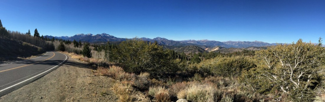
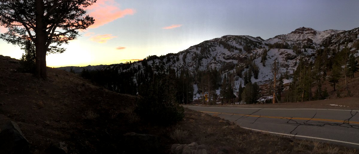
Sonora Pass: It’s all downhill from here.

The historical landmark sign at Sonora Pass. The power of heavy snowfall.
It’s become my tradition upon reaching Sonora Pass to stop for a moment. This year, there’s clear evidence of the heavy snows of last winter. One side of the historical landmark sign is leaning about 15 degrees. A few snow fields remain where last year were none. Absent any human traffic, natural noises abound. Birds scurry in the brush. The wind makes that rushing sound that seems to be specific to high Sierra pines. The almost treeless land to the east is lit by harsh sunshine. The west is still in the shadows of the peaks and trees.
Stopping at the Leavitt Falls Vista Point, I look down upon the West Walker River. Even at 7,800 feet, 1,000 feet above the river, I can see that it’s full of water. The first people I see are a few miles down the road – packers at the Leavitt Meadows Pack Station. A short stop at Pickel Meadow Wildlife Area confirms that the West Walker River isn’t ready to be fished.
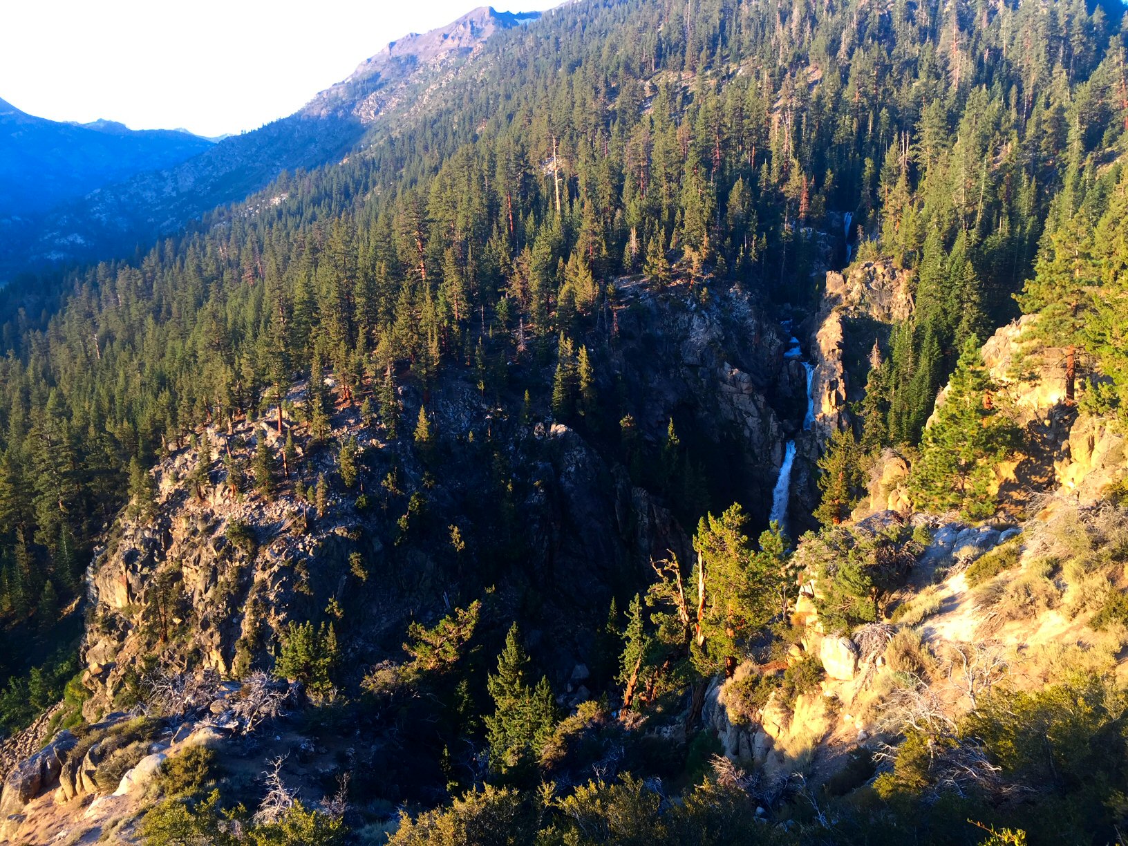
Leavitt Falls in the early morning light.
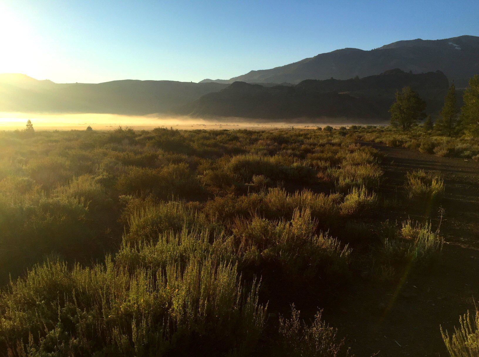
Fog and cows on Pickel Meadow.
I drive on. I pass the oddly quiet Marine Corps Mountain Warfare Training Center. A right turn onto Hwy 395 marks the beginning of long, flat roads. It’s still cool enough that steam rises from Fales Hot Springs. Soon I’m through Bridgeport, across the East Walker River, and southbound.
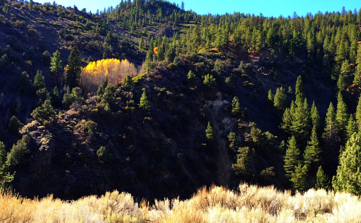
Scattered trees give way to dry high desert. Only in the canyons west of the highway do trees – mostly aspens and pines – find enough water.
South of Mono Lake lies the first exploratory attempt. John, the leader of our little group that’ll be spending a few days terrorizing fish in and around Crowley Lake, suggested a stop at Rush Creek. Originating at about 13,000 feet near Mount Lyell, various feeder streams from Marie Lakes and Davis Lakes combine to form the main stem of Rush Creek, which flows through Waugh Lake, Gem Lake, and Agnew Lake on its way to the June Lake Loop. There it enters and exits Silver Lake, then Grant Lake, before finding its way to Mono Lake.
As a teenager camping at the Silver Lake Campground, mysterious fly fishermen would wade downstream and later reappear with big brown trout. Having never returned to June Lake Loop since then, and since I’d become a passable fly fisherman myself, I thought it was about time for a closer look at Rush Creek. Like many creeks and streams here, Rush Creek is lined by brush dedicated to preventing molestation of fish that might be present. If that weren’t enough to dissuade my thoughts of making of a few investigative casts, the creek – which carries 41% of Mono Basin’s runoff – was filled bank to bank with whitewater, the result of accumulating runoff from last winter’s heavy snowfall over its 27-mile course.
I pull back on to the highway and mull over the idea of returning to June Lake Loop in the future without deciding whether that will be on my own or as the leader of a club trip. Once past the northern turn for June Lake Loop, the miles seem to pass quickly. The asphalt here is smooth and the road relatively straight. It slowly rises and falls, passing through infrequent stands of pines. Unimproved roads regularly sprout from either side of the highway. Calling them dirt roads would give the wrong impression; here they cut into an almost white, gravelly, sandy soil.

It’s become something of a tradition to stop at the Tioga Gas Mart, after a trip many years ago with Christopher, to indulge in this sugary treat.
I turn down one with a sign pointing to Lower Deadman Creek Campground. It’s about two miles before the turn into a small basin that contains the campground and the creek. Here the chaparral gives way to pines. The campground straddles the creek; four of its thirty sites are occupied, but the abundance of water this year makes half the sites unusable.
I geek gear up, stopping to talk with a grad student who’s studying the geology of the area. He points out where he’s seen stocked fish:the likely places – long runs that curve through the campground. Here, towering pines shade this place, allowing the coolness of morning to linger long past sunrise and muffling the sounds of coffee being poured into a mug, a spoon clinking against a cereal bowl, a father beginning to pack the necessities of camping, the grad student strumming a guitar.
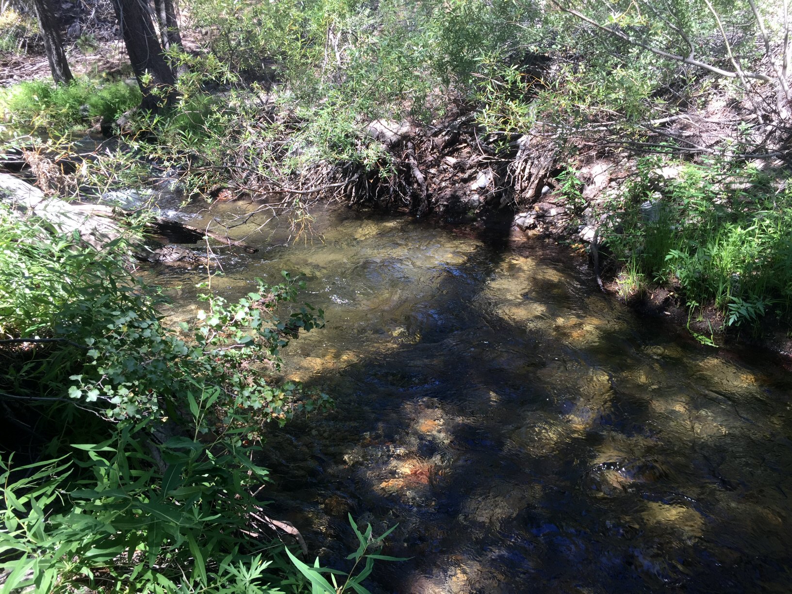
Deadman Creek is much like many Sierra creeks I’ve fished. Its clear water ebbs and flows, tumbling over rocks into bubbling pools and carving out channels under tree roots. I think my 3-weight Winston maybe a bit too much rod for this stream but know its length will come in handy when it comes to poking through the brush that lines the banks of this creek.
I’m here looking for the wild trout that are rumored to be in the upper reaches of Deadman Creek, but I can’t help warming up my casting arm tossing my flies to a few of the human-raised rainbows. My cast is rusty but good enough to lay my flies down on a seam that carries it over a few fish fighting for position in the current. There’s no subtlety about the stocked trout. The lead fish slashes at my dry fly and the other fish scatter. The skunk is off.
The hike upstream makes me grateful that I walk every day. The campground is at 7,800 feet, and I’m headed higher. Half a mile upstream I’m alone. Ripe bitter gooseberries stand out among sage, bunch grasses, willows, and rambling wild rose bushes.
The creek from this point and upstream is no more than three feet wide. I find the wild brook trout that lured me here in nearly every plunge pool and tail-out. There’s contentment to be found in a wild place such as this, and when found it’s the simply being in that place that’s enough.
I turn downstream after about two miles gained in small increments dictated by fishable water. In this canyon it’s either night or day, and during the day there is no sense of time passing in its unchanging shade. It’s just before noon when I get back to the car.
One pool on Deadman Creek that gave up a brook trout, as it should have.
It takes less time to travel the three miles of dirt road to the highway than the 23 miles to the Hot Creek Interpretive site, another place of exploration this trip. I’ve fished the canyon section of Hot Creek, but this section is unfamiliar and different. The unwelcome sight of four trucks already parked in the turnout makes me question my decision to stop here. It’s not a long stretch of water, about 2,000 feet, meandering through fields of sedges.
The reports were true; it’s grasshopper season. I disturb half a dozen every few steps. A dry-dropper setup is my go-to option for Hot Creek. A dry fly – in this case a grasshopper dry fly – to get the attention of fish looking up, and a nymph to get the attention of the greater number of fish hiding beneath Hot Creek’s plentiful aquatic vegetation. This vegetation is partially responsible for making Hot Creek one of the most productive wild trout waters in California, and the single reason it can be difficult to fish. (Thankfully, as a designated wild trout stream, no bait allowed, only artificial flies and lures with barbless hooks, and all catch and release.) Even so, it’s one of the most heavily fished wild trout waters in the state.
Two fishermen downstream force me upstream. The flow’s a bit high, and getting a drag-free drift is not easy. After five casts, I move downstream. On Hot Creek, I favor a mid-stream stretch that offers a clear lane between vegetation, close enough that a raised rod can keep most of the fly line off the water. Maybe it’s a confidence thing, but once I find one of those lanes, I get a few takes. It’s a mix of hits on the dry and subsurface flies, but all come up short.

Great day on Hot Creek. Not so great catching.
It’s not until I’ve leap-frogged past the two fly fishermen – who haven’t moved since I arrived – that I find more willing fish. Just above the fence that marks the private Hot Creek Ranch property, a number of fish hide in the weeds. A fly placed close enough elicits strikes and, with enough casts to the right place at the right time, it’s inevitable that I land one. It’s a small fish by Hot Creek standards, maybe 10 inches, but satisfying.
The sun’s high in the sky now, suggesting that it’s time to meet the rest of the guys at Tom’s Place, just a few miles down the road. Along the way I pass McGee Creek and Crowley Lake. Both are brimming with water this year, and I plan to fish both.
sometimes it’s the place
I held it off as best I could, tried to put some of my favorite waters out of my mind. In the end it was hope, more than gasoline, that propelled me over Sonora Pass a couple of weeks ago.
Over the years I’ve spent many days walking the banks of babbling creeks in the Eastern Sierras. The first to give up wild trout – Molybdenite Creek and Little Walker River – top my list. This is where I landed by first sizable wild rainbow trout.

Moon Over the Little Walker River
I can’t think of these places and others like them without an intensifying need to return. These are familiar places become less so if not visited every year. Often it’s the memory that fades. Sometimes nature exerts its will on the landscape.
It was clear that this would be the first year in a while that runoff from more abundant – but still not plentiful – snowpack would make many rivers and streams unfishable. But a limited amount of vacation time, and hope, were enough of an excuse to make the trip.

Sonora Pass with more snow than last year. Still not enough.
I came in from the west across Sonora Pass, early enough that morning to be alone for the 20 miles between Kennedy Meadows and the Pickel Meadow Wildlife Area. It’s a serpentine road that demands attention, a ribbon of relatively new asphalt that twists and turns, rising through stands of pines to wind-scoured fields of granite before dropping into the starkness of the Eastern Sierra.
Six miles beyond the Sonora Pass summit but before my descent into Pickel Meadows, Hanging Valley Ridge comes into view. The morning sun is still low and the ridge still casts a shadow over much of the meadow. From my vista point, distance masked any audible anger, but the torrent of water working itself into a lather over Leavitt Falls offered a clue as to the difficulty to come.

The first glimpse of the West Walker River was both encouraging and discouraging. It was good to see high waters scouring the river bed and suggesting good summer fishing to come. It also hinted that there’d be little fishing and likely no catching in any of the Walker watershed’s moving waters.

See the path, right there?
This day there would be more hiking, exploring and simply being in the mountains. Contrary to the anger on display as water crashes against rocks, the sound is soothing. Delicate flowers sway in winds that predictably funnel through most mountain canyons.
It was a day without fishing, but not wasted.

Sonora Pass with more snow than last year. Still not enough.

Leavitt Falls

Looking out to the West Walker River from the Leavitt Falls overlook.

The road in.

Moon Over the Little Walker River

The Little Walker River not so little.

See the path, right there?

Not quite ready for tenkara.

exploring before it’s all over
As if it hasn’t been a figuratively dry trout season for me, a long trip last weekend over three passes, along rivers and over two reservoirs showed that things are literally drying up…
This was my last and only second trip to the Sierras during the general trout season. It was happenstance that kept me off the water and only sheer determination — and a desperate desire for a break from every-day life — that crammed a 400-plus mile drive and not enough fishing into a single day.
Firsthand reports dashed any hope of great fishing. Small streams were trickles, meaning wild fish were off limits. State-stocked waters that normally received a few buckets of fish before the end of the season didn’t.
Another view of the sunrise from Sonora Pass.
Optimism being the most overused tool in a fly fisherman’s arsenal, I still hit the road over Sonora Pass before sunup. If there were few fish to be had, at least a sunrise at 9,000 feet doesn’t disappoint. This late in the year, a sunrise seems to last longer.

Looking a bit southwest from Sonora Pass.
There was unexpected company on the West Walker River, a couple planning to soak bait. They went their way, I went mine. I’d have pocket water all to myself, whitefish on the mind, and the sound of reveille arising (a bit too late in the morning this time?) from the Marine Corps Mountain Warfare Training Center.

My “office” for the morning. (West Walker River)
Just like that “confidence fly” most fly fishermen keep tucked away, there are pieces of water one comes to expect to hold fish. My expectation held true this morning. It didn’t take long before a fish was fooled with my favorite red-butt zebra midge pattern. While not large, white tips on smooth fins suggested it was a more educated trout. Even if was a hatchery fish, it had spent enough time in the wild to learn a few things while it’s pectoral and caudal fins healed. There would be no whitefish this year and nothing big, but all of the trout I found were feisty.
This isn’t the time of year that these trout rise to dry flies, but the water level requires stealth, a dry-dropper setup, light casts to small seams and short drifts. It’s hard to disagree that this type of rig might be a reflection of my middle-of-the-road nature, mixing the oft-look’d-down-upon tactic of nymphing with the loftier technique of dry fly fishing. Deep down I hoped for a rise to the dry fly, but ice crunching underfoot suggested it was not to be.
My plans called for crossing Monitor Pass on the way to the East Carson River, then over Ebbetts Pass, and finally completing a twisting and oblong course over the man-made New Melones Lake. Unfamiliar with the route and wary of unpredictable delays, I was on the road again before noon.
Many times I’ve enjoyed driving — whether a car or motorcycle — over Tioga and Sonora passes many times, during the spring, summer and fall. Any threat of snow brings about closures, but during this trip Tioga and Sonora pass, as well as Ebbetts and Monitor pass had reopened after brief snow closures earlier in the week.

Looking west from near Monitor Pass.
The landscape and vegetation of each pass is unique, with stark changes as one gains elevation. Over Monitor Pass, Highway 89 twists between and over numerous peaks, alternating between barren high desert to east and the fir and pine forests on the western slopes. Once over the summit, the road quickly descends to meet Highway 4, then crosses the East Carson River.
This was first visit to the East Carson River. The wild trout section was low and slow, and out of the shadows of the high canyon walls. Sunlight reflected off nearly every eddy, riffle and pool, and, as might be expected, the fishing was great but the catching not. It was suggested after the fact that I should have fished upstream, where a summer of stocking might mean a few stupid willing fish would remain. I chalked this visit up to exploration. Since it wasn’t too far away, I drove to Markleeville. I had to drive through town a second time; I blinked and missed it the first time through.
Colors along Highway 89, just south of the East Carson River.
The route over Ebbetts Pass is more adventurous than the comparatively high-speed Highway 108 over Sonora Pass and Highway 120, which winds through Yosemite and over Tioga Pass.
Driving over Ebbetts Pass is not for the faint of heart. Sandwiched between a full-width, two-lane state highway is a section reminiscent of the descriptions our parents and grandparents might offer of roads built only wide enough that two Model Ts could squeeze by each other. This middle section, from Lake Alpine to Silver Creek, is a barely two-lane road. There is no center line or fog lines. Shoulders are a rarity. Steep curvy portions, precipitous drop-offs and vistas of pristine landscapes are plentiful. If the narrowness of this road isn’t enough to reduce one’s speed, the beauty was. Lack of planning meant I couldn’t linger. Plans are already afoot to return with a greater abundance of time.
Ebbetts Pass tarn.
The rest of my drive was in relatively civilized areas. I’d pick up apple cider outside of Arnold, then wine and special spices in Murphys. I crossed New Melones Lake, which looked more a river at flood stage (it was formed by the damming of the Stanislaus River). Back in Twain Harte early, I cleaned up and planned to attend to a few items on the to-do list, figuring I’d walk to the local Ace store for a halogen bulb and any other necessary item. During the walk I began an exploration of a different variety. More on that next time my fingers are willing to dance on the keyboard…

Leavitt Falls, late in the fall.
All of the photos, and some more:

Sunrise from Emigrant Gap on Highway 108.

Sunrise from Sonora Pass on Highway 108.

Another view of the sunrise from Sonora Pass.

Looking a bit southwest from Sonora Pass.

Looking back toward Sonora Pass.

Over the West Walker River from the Leavitt Falls Vista Point.

Leavitt Falls, late in the fall.

Sun appears over the West Walker River.

My “office” for the morning. (West Walker River)

Looking west from near Monitor Pass.

Colors along Highway 89, just south of the East Carson River.

Looking east from near the top of Ebbetts Pass.

Ebbetts Pass tarn.

Morning traffic outside the cabin.
getting out and up in the Sierras (and personal accomplishment)
My family spent many summer vacations in Tuolumne Meadows. These trips were a family affair and in the interest of keeping everyone engaged, it was more than fishing. We’d spend the days hiking to higher elevations — the campground was at 8,600 feet — and sometimes we’d end up at nearly 10,000 feet. Mepps spinners would be cast into water along the trail and sometimes the destination was a lake where fishing was rumored to be amazing. Mom would keep the troops focused by wondering out loud about what might be around the next bend. My brother and sister and I would spend countless hours exploring the banks of the Tuolumne River, watching the occasional bear that wandered into the campground, and waiting for the rare treat of visiting the campground store, where we’d get to pick one comic book and maybe enjoy an ice cream.
Idealization taints memories but, for me, the Sierra Nevada high country has always lived up to my recollection. That’s what fueled the rest of my plan for Memorial Day Weekend 2014.

The view from where I started.
First-hand reports made it clear that water would be high in the Walker River Basin. But I had a plan that tied into two keywords in my last post: “maturity” and “adventure.” Not to get too personal, but I’m no spring chicken rooster, and for more than five years I’ve worn a compression brace on my right knee. Years ago, while carrying a bag of cement on my shoulder, I stepped into an unseen depression, twisted my knee and fell to the ground. I was young then, so shook it off. It was only years later that I began to feel a bit of pain after long walks. This year I finally got out of my rocker to walk every day. Not Forrest Gump style, but about five miles a day. That, in combination with weight loss, has eliminated the need for the brace.
Cautiously optimistic, in planning for this trip I had decided to walk up the Little Walker River, hoping this would rekindle my enjoyment of high country hikes. I enjoy fishing this creek’s small water, though most of my experience had been limited to the stretch through and downstream of the campground. Sticking to my plan, I ignored warnings of high and muddy water. The drive over Sonora Pass would take about two hours, but it’s one drive that’s always enjoyable as the terrain changes with the elevation and, particularly this time of year, snow still dusts the pass. This day the drive was even more pleasant; being a weekday I saw only four cars at lower elevations, and no one above 6,000 feet.
The section of Hwy 108 between Twain Harte and the junction with Hwy 395 rarely runs straight. It’s a good road and relatively fast considering the twists and turns. On the eastside, after beginning a descent into the high desert, there are at least four severe hairpin turns. It seems that every year I either run into a cattle drive on the highway or a semi-trailer truck stuck at a hairpin. This year it was another truck. I waited about 10 minutes as the driver unsuccessfully tried to free the drive wheels, which had sunk in the loose dirt on the inside of the turn, before walking up to ask if it would be okay to try to drive around on the shoulder. He helped me move a few big rocks. After getting past, I was talking with the driver, emphasizing that this hairpin was only the first, when assistance arrived in the form of a Ford Police Interceptor Utility in California Highway Patrol colors.
The longest part of this drive always seems to be the three or so miles down a washboard dirt road to the Obsidian Campground in the Humboldt-Toiyabe National Forest. It’s not a bad drive, and was made nicer this year by a late-season storm that dropped enough rain to keep the dust down. Best of all: I was the only person there.

One of many fallen trees…
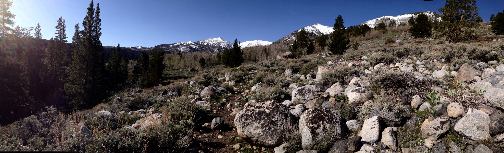
I began hiking where a bridge crosses the Little Walker. Topographical maps showed a nearby trail, but that trail would only appear intermittently during my hike. This part of the river flows through a narrow canyon, and since my preferred tactic is to hike as far up as possible and return by slowly fish downstream, I headed for high ground. This is terrain marked by small and rounded granite cobbles, perhaps glacial debris, sandy loams and decomposed granite. Willow and quaking aspen grow along the creek, replaced by conifers and mountain hemlock, which tolerate a drier environment. Hiking was relatively easy. There’s not much underbrush and the only hurdles — literally — were the many downed trees.
After about an hour I emerged from the canyon to find the wide-open expanse of Burt Canyon. Here the Little Walker meanders through stands of willows. The mountains that looked so far away when I started at about 7,400 feet seemed to be within reach. That was clearly an optical illusion as I was at about 8,600 feet and those mountains scraped the sky. The hiking was easy here and I continued on for about another hour.
I find solitude to be refreshing, so I pulled up a boulder and sat. Handfuls of raisins fed my body. The silence of the mountains, the sound of birds and gurgling water, and the unfathomable history of this place, fed my mind and soul. It was as if I was one of only few humans to pass this way.

The view in Burt Canyon, where I turned around.
Shaking off such romanticism, I rigged up the 3 wt. rod. This is the type of water that begs for a dry fly, with the usual small dropper. I fished suspect water, sneaking through willows as best I could, but apparently not well enough. I re-entered the narrow canyon of the Little Walker River with only a single rise so far.
It took a combination of hiking, climbing and crawling to follow the course of the creek, which wound around boulders, under fallen trees, sometimes cascading ten feet. The water was indeed high. Side arm casting, parallel to the creek was the best option. The fish were there, and a few rose to my fly, but none with enough an appetite to bite. If you fish, you know that there are those special spots that you know must hold fish. During high water flows, those locations change, and observation is the name of the game.
I had taken to hiking above the narrowest sections of the canyon and noticed one such spot. A large boulder was forcing the creek to bend almost ninety degrees, so that even at high flows, a pool was created. A large pine offered shade and security.
Hugging the conifer to hide my profile, my first cast fell into place and the fly slipped along a seam. I let it flow around the boulder until out of sight but before my fly line could spook any fish higher up in the pool. On the third or fourth cast a fish slammed the dry. This wasn’t a long pool, so the fish was resigned to head shaking and circling, but it did stress my little rod. I hadn’t expected to find a thirteen-inch holdover rainbow, but that’s what I was looking at in the net. That pool gave up a few more small fish, wild rainbow and brook trout of no more than eight inches, before I moved on.
Confident these fish could be fooled, it was time to stop for lunch in a small meadow passed on the hike upstream. The entrée was a jelly sandwich — I forgot to buy peanut butter at Twain Harte Market — accompanied by pretzels and raisins for dessert. During this repast, telltale rises in a slow bend caught my attention.
Lunch finished, I crept up to the edge of the creek. I made my first casts while still a few feet away; the high water had fish hugging the banks. The fish landed was a bright wild rainbow. A cast to the far bank brought up a couple of brilliantly colored brook trout. Feeling accomplished, I started to hike back to the car.
Panorama from a stop along the Little Walker.
The bridge where I had parked came into sight, and below another fly fisherman, dappling a small pool. In short order he had hooked a big hatchery rainbow. His problem was getting it in the net. The pool was at the limit of the reach of his 5 wt., maybe nine feet, and the skinny water in this wide spot of the creek meant the rod often had to manage the full weight of the struggling fish. It wasn’t until I was on the bridge and ready to render aid, that he had the fish in the net. We chatted briefly before he headed off to clean his lunch.
That morning, in my focus on the adventure ahead, I hadn’t taken a good look at the water around this bridge. Now I could see that, directly underneath, it offered some interesting water. I clambered down. Fish hit my flies cast after cast. The hatchery rainbows were numerous and hooking one was a non-event. It was the occasional brook trout that made it fun. The challenge was getting my flies past the rainbows at the top of the run so the brookies at the bottom could get a look. I’m not complaining about having a chance at numerous fish, but I had come here for the wild ones.
On my way to the Little Walker, a quick look at the West Walker revealed it was running high, but clear. Knowing that time was limited if I was to get back over the pass before dark, I packed up and headed to Pickel Meadow. During the regular season the Pickel Meadow dirt parking lot would have half a dozen cars in it. This early in the season there were only two cars and three fly fisherman.
They had been fishing all morning and had found fish stacked up in a few bends. High-stick nymphing had worked best. And clearly, these guys have a more class than I; they were setting up a table and chairs for lunch, with all the fixin’s for Dagwood sandwiches. They also gave me explicit directions on how to get to the best spots (walk to the second willow and cast downstream) and told me to have at ‘em.
Perhaps it was laziness, but I decided to stick with a dry dropper. The fish were easy to spot, and I’m sure I was from their point of view, so I tried to hide behind a third willow while casting upstream. Helped by a twelve-foot leader, good drifts prompted rises to the dry fly. Proving that hatchery fish tend to be dumber, I had landed almost a dozen in less than an hour.
About then, one of the gentlemen from the parking lot walked up and asked what I was doing to hook so many fish. He was new to fly fishing, but enjoying it so far. We talked tactics and I again found myself in the role of teacher. I shared some flies with him and recommended other nearby waters. Then it was time to head back to the cabin.
It’s taken me seven-plus years to take “catching” out of the equation of fishing. Now I’m able to hike, if not with the energy of my teenage self, at least without getting (too) winded or an aching knee.
Mission accomplished.

The view from where I started.

One of many fallen trees…

Panorama from a stop along the Little Walker.

There was still snow in the shade.

A copious amount flowing down the Little Walker.

A great dining room for a modest lunch.

The Little Walker River in Burt Canyon.

The view in Burt Canyon, where I turned around.
is one California too much, or how do you feel about buying multiple fishing licenses?
Though it’s a remote possibility that the proposal by Silicon Valley venture capitalist Tim Draper to divide California into six states would make it over the many required hurdles — from gathering signatures of 807,615 registered voters to put the measure on the ballot to final congressional approval — it presents a conundrum for a native Californian.
This is a big state, one of diversity. Every once and a while that diversity bubbles to the surface; one example is the Jefferson state movement that is revisited every decade or so. Boards of supervisors in Modoc and Siskiyou counties, which are near the Oregon border, approved measures in support of the Jefferson state declaration. Tehama County, one county south of Modoc and Siskiyou, has placed a similar measure on the ballot.
California is one of the few places where five major climate types can be in close proximity. From my home, it’s a four-hour drive to the high Sierras, the Humboldt redwoods or the southern coastline. The same goes with fishing: steelhead to the north, Striped bass to the east, trout to the northeast and southeast, saltwater fish to the west.
Setting aside all the pros and cons about and difficulties of creating smaller California state, it raises the possibility, just to fish for trout in place I enjoy, that I’d have to buy three separate licenses. Saltwater fishing could require a fourth. This may be an accepted part of living in smaller states, but not something I look forward to.
One upside might be the possibility that the proposed state I would live in, “North California,” could regain its water rights. I’m sure we’d set a fair price for all that water needed down south.
no longer just fair-weather fishing
I’d never thought of myself as a fair-weather fisherman until last month. The truth is that the timing of my fishing trips — most of which take place within a few hours drive of our cabin in the Sierra foothills — is more often dictated by the level of water and the appetites of the trout in it. There are plenty of sources for information that will give you an idea of what might be expected when you get where you’re going, but usually doesn’t match up with the reality of being there.
Last month I had left the cabin on an outing that began like any other early-morning trip over Sonora Pass. I left before sunrise, the roads were vacant and it was about 40 degrees F. The general idea was to visit previously unvisited areas of a nearby watershed, with no specific plan in mind.
The elevation of the cabin is about 3,600 feet, where autumn is generally makes its presence known in a pleasant manner. Leaves are beginning to change and there’s a nip in the air. Short sleeves are still comfortable most of the now shorter daylight hours.
The temperature fell as I began to climb toward the pass, and blotches of yellows and reds more frequently peeked out from behind the evergreens. By the time I arrived at Kennedy Meadows (elevation 6,700 feet), it was about half an hour past sunrise, but in the shadows of this piñon-juniper forest, it was 27 degrees. In 10 more miles I climbed another 3,000 feet, emerged from the tree line, and the temperature would rise about 25 degrees.
I have a fondness for the high country — because its beauty is one of stark contrasts, in some ways harsh but fragile in others, with dwarfed pines scrapping out an existence against a background of granite — and this dramatic variation in temperatures is one of the most observable influences on that beauty. The simple expansion of water as it becomes ice slowly breaks down granite. The melting of that ice, and snow, as well as a general weathering of the landscape, breaks that granite into pieces that, through weather and the activities of insects and animals, can be mixed with decomposed plant matter to create a thin and rocky soil. It’s truly amazing that such infertile soil supports numerous conifers of all shapes and sizes.
The descent on the east side of the mountains leads down to the high desert, where desolation of this shrubland is interrupted by strings of trees, usually aspens in the canyons and pines elsewhere, following the course of the rivers and streams of the Walker watershed. The sun gathers strength here, but this morning its power would be contested by a layer of cold air that had established a foothold during the night.

River-side ice at 26 degrees that morning.
There’s always that time, between emerging from the artificial environmental cocoon of a vehicle and before the cold really starts to bite, that the air temperature never seems that cold. When I pulled alongside likely looking water, it was 26 degrees. I had given serious consideration to the idea it would be chilly, but now worried I hadn’t considered it seriously enough.
So with the thought that I had come too far and retreat wasn’t an option, I began the layering that I hoped would suffice. This was comprised of fleece pants under the waders, a wind-proof wading jacket over a fleece sweatshirt that was on top of my long sleeve shirt, and a well-worn, wide-brim canvas hat. Later I’d realize that my fingerless fishing gloves would have been a welcome addition.
As long as I kept moving, I avoided the long shadows that persisted as the sun hung low along its autumnal path. The water was 58 degrees, at the low end at which trout will be active, so I didn’t linger too long in one spot and moved frequently to cover as much water as possible.
This was an entirely new experience. My breath hung in the air, lingering as puffs of white. Skim ice crunched underfoot. My guides iced up within fifteen minutes. It was cold. So cold that I almost — almost — hoped that wouldn’t have to plunge my hand into the water to unhook a fish.
I would leave this first spot about an hour later, skunked but feeling that for that brief time, more than ever, that I couldn’t escape being part of nature.
