I think the most rewarding fish I ever caught was vivid wild rainbow from Hot Creek, one cold fall morning a few years ago. It wasn’t the biggest fish and it wasn’t the first. It was the one that confirmed I was doing something right. There have been quite a few fish since then, but this is one that stands out.

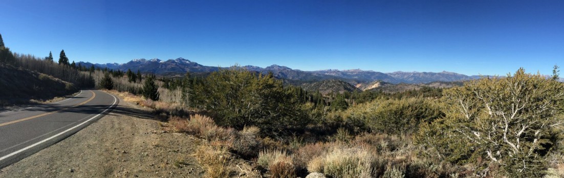
Early morning on Hot Creek, looking west to the Sierras.
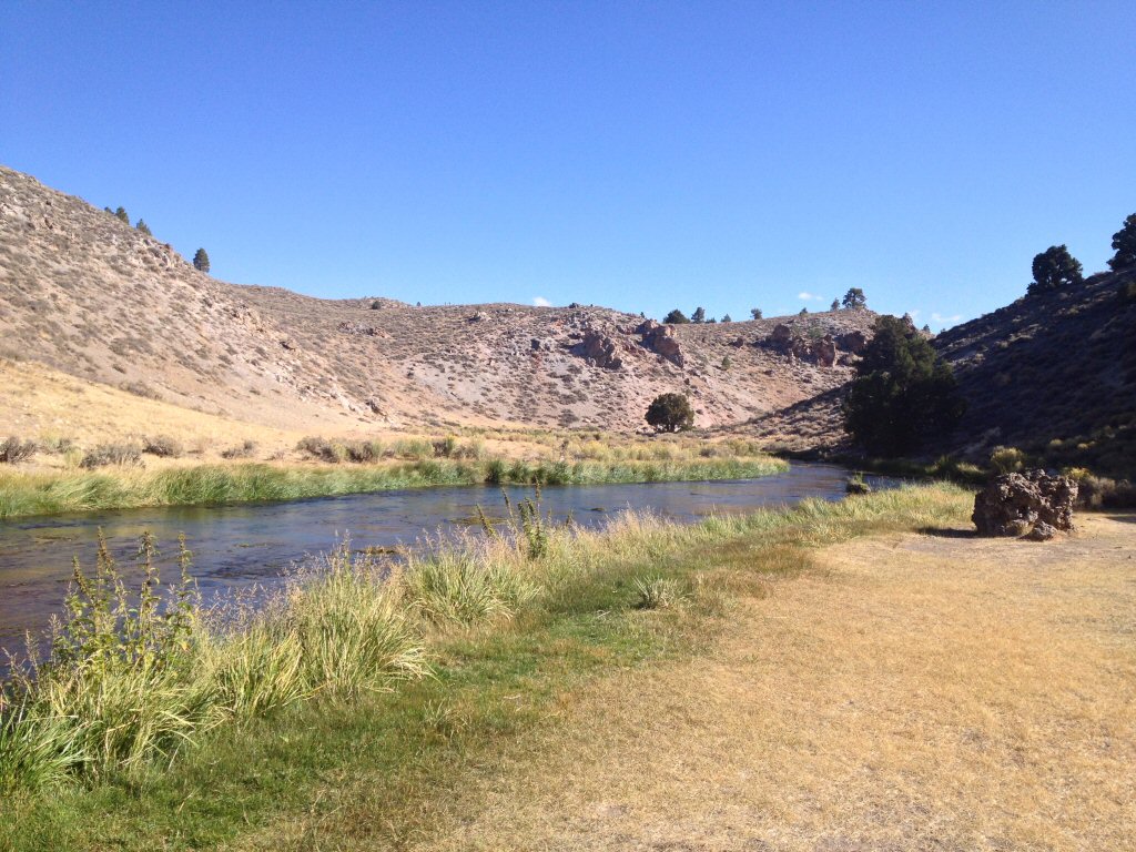
I’ve described Hot Creek as a personal crucible that draws me back whenever I’m near. It’s the kind of place you’d return to regardless of the fishing. Early in the morning, before the sun rises above the canyon walls and less hardy fisherman show up, it can be a meditative place. The last four years I’ve been alone during this time, at least without human company. Deer will eye me while slowly munching on weeds from the creek. Birds of all shapes and sizes fly over and flit about the stream as caddis begin to hatch. Dark shadows of trout slip between the weeds.
Hot Creek is a gift plunked down in the middle of some of the most gorgeous country. It flows for about 3 miles through a huge meadow of wildflowers and tall grasses — which has been under the private ownership of Hot Creek Ranch for decades — and is surrounded on one side by the Sierra Nevada Mountains and on the other by the high desert of the Long Valley Caldera, which stretches about 10 miles to the Glass Mountain Ridge. The most fished public stretch flows through Hot Creek Gorge, below the ranch.
This year the creek offered a special challenge: low water and weeds. Hot Creek is known for the weeds that make it such a prolific stream; weeds that necessitate good casts to small lanes if one is to expect a decent drift.
This year those lanes seemed to be half as wide and half as long. Most of the fish where either hovering at the beginning or the end of these lanes, or just at or under the edges of the weeds. Some could be seen. Others were revealed as they fed on something too small be seen.
Solitude on Hot Creek.
If there’s one consistency at Hot Creek, at least during the fall, it’s the size of the flies that work best. A favorite among our group this year was a small Zebra Midge, but for me it was a size 20 CDC Caddis. I needed help seeing a fly that small, so this day it would trail a decent sized grasshopper pattern.
These days I tend to use dry flies more often as indicator in slower moving waters. I did so during my first visit to Hot Creek. Not because I wanted to, but because everything I had read and been told about this stream deemed it “highly technical.” I still don’t really know what those words mean when used to describe a river, stream or creek, but they were scary at the time.
These days, Hot Creek treats me fairly. Choosing the proper fly, casting well to the right spot and getting a good drift is generally rewards one with a strike. Whether or not that fish makes it to the net is up to me. This year, of about a dozen fish hooked, I’d lose half of them in the weeds. Others would throw the hook after going airborne. Only three would make it to hand for quick release.
I spent all of the morning and much of the afternoon fishing and exploring, visiting a lower section of the creek for the first time, and eating lunch about 30 feet above the creek while watching rising fish and mesmerized by the vivid landscape around me. It took more effort than usual to leave.
Somewhere along the line I read about a guy who fishes the Eastern Sierra, and on his vehicle is a bumper sticker that reads, “Don’t believe everything you think.” Appropriate for Hot Creek.